From we move to Dombay.
Little has been said about Dombay lately. He became unfashionable. Krasnaya Polyana is a different matter. Here you have Putin with official and other visits. And federal programs with numbers that Alpine resorts have never dreamed of. And “Radisson”, and “Gazprom”, and Sochi-2014, and advertising of cottages on Moscow banners... Rublyovka branch, no matter what.
Only Krasnaya Polyana is still far from Courchevel and Chamonix. And the ski season in the vicinity of Sochi is short: at the end of March you can already cover your skis. And in Dombay they ride until June, at such heights that they take your breath away. If the main slopes of Krasnaya Polyana are located at a little over two thousand meters, then in Dombai the height of 2266 is called the “lowest point”: from here the ascent to the main ski area just begins. The total length of the ski slopes is more than 20 kilometers.
Those who understand and those whose hearts were left in the Dombay mountains a long time ago go to Dombay - in those days when “skis by the stove” were in every Dnepr reel-to-reel tape recorder. But to say that Dombay today attracts mainly nostalgic people of pre-retirement age would be a great exaggeration. Rather, on the contrary, this is one of the youngest resorts in Russia in terms of the composition of vacationers. The first and main reason for this is cheapness. In terms of average prices, Dombay significantly outperforms even the ski resorts of Bulgaria, not to mention Austria or France. Therefore, with the beginning of the season, strings of “student” trains stretch here: young and not very wealthy companies go to Dombay for romance and extreme sports. In 2014, the internal flow of tourists reached 500 thousand people.
The most influential and main enthusiast of Dombay was the Chairman of the Council of Ministers of the USSR, Alexey Nikolaevich Kosygin. Many of the instructors remember his visits to Dombay and gratefully note that if it were not for Kosygin, there might not have been a resort in this fabulous place at all. It was he who gave a powerful impetus to the development of resort infrastructure here - in those distant Soviet times, when, by and large, no one was involved in tourism.
Once in Finland, President Kekkonen invited Kosygin on a ski trip. Having thus learned about the “Finnish friend’s” passion for skiing, Alexey Nikolaevich decided at all costs to please him with a similar walk during his return visit. But here’s the problem: there was no resort in the Soviet Union at that time, where it would not be a shame to receive such a guest. There was an urgent need to create it, and the choice fell on Dombay, where previously mostly climbers and a few savage tourists went. So in the 60s of the last century, by decision of the party and government, a ski construction boom was declared in Dombay.
Kekkonen came to these places more than once, skied on the Dombay slopes and even walked, as old-timers say, together with Kosygin along the famous all-Union tourist route No. 43 - from Dombay through the Klukhorsky pass to the Black Sea itself, to Sukhumi.
In gratitude for the warm welcome, in 1979 the Finnish president gave the resort a generous gift - the famous high-mountain “plate” hotel, which became a kind of calling card of Dombay.
The “Tarelka” hotel in the Dombay mountains is located at an altitude of 2250 m. From here there is a stunning panorama of the Alibek gorge, further on there are trails to the Alibek glacier, in front of which a shelter hut is built.

Scheme of cable cars and ski slopes in Dombay.

Alibek Glacier and Bilingual Glacier.


Mount Dombay-Ulgen is the highest, most majestic and beautiful peak of the Western Caucasus. The height of the mountain is 4046 m above sea level.It is located on the border with Abkhazia.
However, its mighty massif includes three peaks: Main (4049 meters), Western (4036 meters) and Eastern (3950 meters).

Flight on a paraglider over the mountain peaks of Dombay

Mount Tooth Sufuruju (3630 m.)

Mount Belalakaya. Belalakaya is considered the calling card of Dombay. This mountain beauty can be seen from many points in the Dombay region.

Mount Sufrudju. The peak of Mount Sufrudju has a height of 3781 meters.

The Dzhuguturluchat mountain range is part of the Greater Caucasus Range and stretches 3921 meters up into the clouds. The mountain is inhabited by herds of aurochs, and therefore the Karachays called it Dzhuguturluchat, or auroch pasture.

Glaciers of Dombay.

Mount Belalakaya (3851 m.). View from Mount Mussa-Achitara.

Mount Sufruju and Tooth of Sufruju(3600 m.)

Mussa-Achitara Ridge. It is located separately, parallel to the Main Caucasus Range. (3012 m.) From here a beautiful panorama of the Main
Caucasus ridge, Elbrus visible.

View of Elbrus from the Mussa-Achitara ridge. From here, in a straight line, 65 km to Elbrus and 65 km to the Black Sea.

View from Mount Mussa-Achitara to the mountainBelalakaya (3851 m.) and to the glaciers of the Amanauz gorge.

Mount Aksaut (3910 m.). The Aksaut mountain range is a ridge stretching from southeast to northwest with a central ridge that
looks northeast.

The best skiing area is considered to be the southwestern slopes of Mount Mussa-Achitara.This Dombay ski area is located at an altitude of 1630-3168 m. In the upper part of the slope the track is flat,
calm without sharp changes. This route is ideal for those who still feel unsure about skiing.


At the bottom of the ski slope the slope is steeper, with some bumps. Here are the so-called “red”, and sometimes even “black” areas for skiing,
bringing a certain thrill to skiers.


And so it happened. Vlad called in the morning, we met and went on our first hike around Dombay. All trips were and were supposed to be one-day trips, with overnight stays in a hotel.
I don’t know if it makes sense to dwell on the hotel in detail. In such cases, I don’t need much from them. A bed, hot water, a clean bathroom at a minimum, Wi-Fi and a TV at a maximum. Yes, in general, I’m not used to living in tents, without hot water and a bed. The Zvezdny Hotel, where we stayed, is the second building from the white Dombay sign on the left side. It fully corresponded to the minimum and maximum, but otherwise it would hardly be suitable for those for whom the hotel is not a transshipment base, but a place of comfortable rest. Some sloppy doors, some unlocked locks on the bathroom, poor Wi-Fi, ancient TVs showing three channels, and other little things. Which didn't affect me personally.
So, it’s morning, the first active day in Dombay.
We met with Vlad and learned that another girl from Moscow had been added to our group. Thus, our group consisted of four people, plus an instructor. According to the program, the first day was supposed to be a walking and easy day, to warm up before the rest of the days, which were more difficult. But Vlad decided to modify the program, diversify it (going up and down the same route is really kind of boring), and took us through the program of the second day, but slightly modified. As it turned out later, this was a mistake :)
His idea was to climb to the top of Mount Mussa-Achitara (3000 m above sea level) by cable car, and from there move to the neighboring peak (+200 meters up) on foot. We, of course, agreed - we had no plans to wipe out all our legs at once, we had plans to climb up and have a look, and the cable car was a great help in this. Then, according to the plan, it was supposed to descend back to Dombay (it is located at an altitude of 1590, but we were not supposed to descend directly into it, but somewhere to the level of 1500, and then go vertical 100 meters up the asphalt road to Dombay).
Go
Moussa-Achitara is a ski slope, the main one during the season. There are two different lines of lifts, divided into stages that take you to different heights. To climb from Dombay to 3200 without discounts costs 4 lines for 250 rubles, plus the fifth for 200. We walked the fifth line.
Transport

Let's rise


Someone walked all the way up

Hotel

Avalanche gun

Kinds


Dombay

Glacier


The last line of the cable car. We're on foot.

Vegetation above three thousand meters above sea level.

Summer


Teberda River. If you look closely, you can see the city of Teberda.

Ozertso. There will be a rest and tea near it. But we still have to go down to it.

Elbrus. Locals pronounce this word with emphasis on the last syllable. In clear weather it is perfectly visible. When we are here for the second time, there will be very little haze, but we will not see Elbrus.


Turii... waste.

Kinds


Vlad


Me too

And then I suddenly discovered that I had brought with me a group that was quite capable of walking, but walking exclusively on flat surfaces. Everyone climbed to 3200. At the beginning of the descent, when I had not even begun to feel short of breath, it became obvious that one person had to be sent back on the cable car.
While descending at about the same 3000, it was discovered that another person could not walk. Well, that is. maybe, but mountain crossings are difficult for him/her. Vlad immediately got involved, gave him his trekking poles, and began to help. At level 3000 there was still snow, the actively shining sun reflected ultraviolet light from it, I just felt my skin say “shhhhhh” and wrapped my face in a bandana. Still didn't help. In Dombay the sun is very biting. 8:30 at this time of year is still normal. And at 9:00 it already begins to bite and burn.


Somewhere at the same 3000, a little lower, I discovered that my right knee began to protest against such surfaces. At first it gave some minor signals of pain, which I ignored, but soon it said, “Okay, you won’t bend me anymore.” Dear mother, we are still at 3000, we have just passed the subnival belt of vegetation, and we have to go down to 1500 - there are still stones, alpine meadows, human-sized grass, forest, windbreaks, almost vertical descents...
Vegetation zone diagram

It's not the worst surface we've walked on.

At first I walked silently, observing the dynamics. Then I realized that the dynamics were negative. On your left leg - at least jump. But the right one gave out the number. This happened once already two years ago in Kamchatka, when they descended from Mutnovsky volcano. But it passed that same day, it didn’t happen again, somehow I didn’t expect such an ambush.
Now we will pass through thickets of rhododendron, then a small stone ridge, then a small descent and there will be a halt near the lake. The leg no longer bends. I drove through the rhododendrons while sitting. We descended from the level of stones to the level of grass. It's still a long way to get to the trees. Among the trees too.

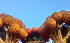
The rhododendron below has already bloomed

I was repaired with an elastic bandage at a rest stop near the lake. I remembered that I have four limbs, not two :) Then they treated me to trekking poles. Vlad looked at our lame team completely calmly. He encouraged us and said that we would go down anyway, even if they had to carry us. Well, me too... I didn’t moan, but just cursed to myself :)


A lonely birch tree came from somewhere. They are all so “lying” there, they are crushed by avalanches.

It was very, very beautiful all around, but with acute pain, and with the still tall grass clinging to your leg, and through the wind, and with the realization that you still have to go and go...
Alpine forbs

Another lake. We go down to him. The angle of inclination... is not inspiring :)

The shot is also about the angle of inclination. An old pine tree. Its top is not far from me and at eye level. Well, in general. We reached another level, trees appeared.

There is a lot of water. Here. There are mountains where you won’t find water for the first three hours of a very steep climb. Semyonov-bashi, for example. And there are enough sources for Mussa-Achitara. Well, as sources. This is all melt water from glaciers. Very tasty. Drink from any puddle - please.

Mishkino rookery. The owner has not been found.

Go, Dima, go. It will get dark soon.

Once again about surfaces and angles of inclination.

Huge firs. One of the last shots of this day. It will soon be dark. For the last half hour, somewhere else it will be impossible to see where to step.

In general, the descent took 9 hours :) We went down to the asphalt, then along it three kilometers to the Teberda-Dombay highway, and then six along the highway to Dombay. We decided that we would call a taxi for the last six kilometers. Yes. 400 rubles. 6 kilometers on asphalt. And we also gave you a discount. I do not like? Well, go on foot. I like it, I like it.
Still, I'm a sucker :) Well, what kind of asshole do you have to be to spend so much time getting ready, preparing, negotiating, organizing, coming so far away and cutting yourself off on the first day?
But still, I'm cool :) Going down from 3000 to 1500 (that's, for a second, the height of a 500-story building) on one leg and far from using an elevator...
The only remaining walking person from our group, when he stepped out onto the asphalt, he immediately twisted his ankle :)) Just like in the little rhyme about ten little Indians. One by one they clicked out. Thus, by the end of the first day we had no walking people left. Vlad later admitted that we should have stuck closer to the program, the first day there was quite gentle, we would have diverged. But he wanted to diversify the program and at the same time see how we walk. Well, I looked :) In general, he said that it’s clear from me that I’m “walking”, and no one is immune from injury. Out of politeness, probably. Anyway.
Vlad also admitted that we are great emotionally. It was obvious that it was very painful, but no one complained, they joked about something. In his practice, according to him, in such situations there was nothing but. Tears, hysterics, swearing...
Due to the fact that I had no idea how I would feel the next day, and neither did the others, Vlad and I agreed to call the next morning.
Dombay is a small village in Karachay-Cherkessia. This is a unique place where several gorges of the Caucasus converge at one point, forming the Dombay glade. The resort village of Dombay was already well known in Soviet times among athletes, climbers and mountain hikers. Modern Dombay is one of the ski resorts of the North Caucasus. There are so many beautiful places, lakes and waterfalls in the gorges of Dombay that tourism is popular here both in winter and summer. The summer season in the North Caucasus lasts from June to October - this is the best time to come to Dombay.
Excursion to Dombay
Excursions to Dombay are offered all year round by all travel companies in any city of the Caucasian Mineralnye Vody. If you are staying in Pyatigorsk, Essentuki or Kislovodsk, then you can go to Dombay as part of such a one-day excursion. The excursion to Dombay is considered long-distance and the entire route will take about 10 hours. The cost of the excursion is from 1500 rubles per person.
Excursion programs of travel companies may differ from each other, but not much. On the way to Dombay, the guide will tell you a lot of interesting things about the history of the Caucasus and Karachay-Cherkessia. Upon arrival in the village of Dombay, free time is provided. For an additional fee, you can take a cable car ride to the Mussa-Achitara peak or walk around the village and have lunch in one of the many cafes. For the first acquaintance with Dombay, a one-day excursion is enough to definitely return here, but only for a few days.
Cable cars in Dombay
If you come to the village of Dombay for the first time, you will definitely want to look at the mountains from a bird's eye view. There is such an opportunity in Dombay. Several gondola and chair lifts will take you one by one to the peak of Mount Mussa-Achitara, from where the giant Elbrus and the Main Caucasus Range are visible in good weather. If you find yourself in Dombay in rainy weather, then do not despair. Walking in the clouds is a pleasure of a different order. The climb to Mount Mussa-Achitara is the main and most easily accessible attraction of Dombay. You only need to choose which cable car to take. All cable cars in Dombay can be divided into two types: old and new complex.
Where to live on vacation?
Booking system Booking.com the oldest on the Russian market. Hundreds of thousands of accommodation options from apartments and hostels to hotels. You can find a suitable accommodation option at a good price.
If you don’t book a hotel now, you risk overpaying later. Book your accommodation via Booking.com
The old complex of cable cars was built back in Soviet times and is represented by a chairlift of 5 stages. The cost of lifting is less than at the new complex, as is the speed of lifting. The old chairlift is ideal for a leisurely excursion. 
The new complex of cable cars consists of modern gondola and chairlifts of 3 stages. The modern cable car was opened in 2008. We'll tell you more about the new complex. 
There are other ski lifts in Dombay. During the ski season, there are several towing lifts and a pendulum cable car with two carriages with a capacity of 35 people each. 
The first stage of the Dombay-1 cable car
The village of Dombay is located at an altitude of 1590 meters above sea level. It is from this height that the 8-seater cabin of the first stage of the cable car starts. The comfortable gondola cabins are equipped with ski pockets. The doors open and close automatically on the landing. In just 6 minutes, the cabin rises 687 meters to 2277 meters.
Here, as in the village of Dombay, there is a market where you can buy everything that is produced by local residents and grown on the slopes of the mountains: herbal preparations, honey, jam, nuts, knitted items, sheep skins and much more. Prices are absolutely no different at the bottom and at the top. In addition to the market, there are several cafes where you can have a delicious meal. 

From a height of 2277 meters a fantastic panorama of the mountains opens up. It will not be a revelation to anyone if we say that mountains look different from different heights. Therefore, the same peaks will open up for you from new angles. And the higher you go, the more interesting the horizon will be. At this mark the peak of Mount Belalakaya is clearly visible. Due to the almost identical shape of the peak, it is often compared to the Matterhorn mountain, which is located in the Pennine Alps.
In the photo in the center you can see the Alibek gorge and the Alibek waterfall, a little to the left is Mount Belalakaya and the Amanauz gorge. 
The guide will definitely tell you about the local legend about Teatralny Peak. Named after a group of artists stuck at the peak and calling for help. The group was evacuated, and the peak acquired its own name. This is roughly the situation with peaks in the mountains; there are so many of them that not all of them are given names. For example, here in Dombay there is also a peak of Drunken Hairdressers. By analogy with Teatralny Peak, it’s easy to guess how it happened. Teatralny Peak in the photo is the highest point on the left. 
Next to the Teatralny peak is Mount Dzhuguturlyuchat and right in front of it is the Ine peak, whose height is 3455 meters. At some observation points, Ine Peak is visually difficult to separate from the mountain. The slope of Mount Dzhuguturlyuchat is covered by the Northern Dzhuguturlyuchat glacier. The Dzhuguturlyuchat waterfall is located under the glacier; it is also clearly visible from the observation point. 

If you look further to the left, you can already see Mount Dombay-Ulgen. The height of the peak is 4046 meters. From the Karachay language the phrase “dombai ulgen” is translated as “killed bison.” Ironically, the mountain was so named long before the extermination of the last bison in the region. In the photo, Mount Dombay-Ulgen is on the left. 
The second stage of the cable car - “Dombay-2”
The second stage of the climb is a 6-seater open chairlift, which will take us from a height of 2277 meters to a height of 3008 meters. In 8 minutes we overcome a rise of 731 meters. There are also several catering establishments and a small market here. In addition, here you can ride ATVs in summer and snowmobiles in winter.

The famous Hotel "Tarelka" was moved from an altitude of 2277 meters to 2600 meters. 


When planning to climb the Mussa-Achitara peak, take into account the significant temperature difference. Always keep in mind the simplest temperature calculation scheme, according to which for every 100 meters of altitude the temperature drops by 0.5-0.6 degrees. Thus, if the temperature in the village of Dombay at an altitude of 1600 meters is 20 degrees Celsius, then at an altitude of 2277 meters it already drops by 4 degrees and becomes 16 degrees. At the highest point of Mount Mussa-Achitara (3200), the temperature will drop by another 6 degrees. 


The weather station offers a wonderful view of the Teberda and Gonachkhir gorges. You can look at the brilliant strip of the Teberda River for a long time. Or consider the Gonachkhir Gorge and the Military-Sukhumi Road laid along it. In addition, the Second Mussa-Achitar Lake is clearly visible from here. Where is the first one, you ask? The first Mussa-Achitarskoe lake is located to the right of the second, behind the nearest hill, it is not visible from this vantage point. 


At an altitude of 3008 meters, even in June the snow depth reaches a person’s height. 
On the other side you can see the peak of Dombay-Ulgen. 
And in good weather, Elbrus is already visible from here. He hides behind the peaks of the mountains. Its appearance is unusual; instead of two peaks, only its western peak is visible from Dombay. To see Elbrus you need to look east. 
The third stage of the cable car - “Dombay-3”
The third stage of the climb is a 4-seater open chairlift, which will take us from a height of 3008 meters to a height of 3168 meters. This is the shortest line of the cable car. In 5 minutes we overcome a rise of 160 meters. 


From the chairlift station to the top of Moussa Achitara you need to walk only 40 meters. The climb will not be difficult. And the views from the top of the mountain are magical. 


The village of Dombay is visible below. And in front of us are mountains. From left to right is the Sufrudju Tooth, whose height is 3600 meters, Belalakaya, Alibek Gorge and Mount Aksaut. 
From the upper station of the cable car, Elbrus is even better visible; the view is not interfered with by the peaks of the mountains. 

Mussa-Achitara Peak
The height of Mount Mussa-Achitara is 3200 meters. From the top of Mussa-Achitara there are views that are inaccessible from other climbing points. The gorge and the Ptysh River and Mount Dombay-Ulgen are clearly visible. 


Means Moussa's crying.
Ridge Moussa-Achitara located separately, parallel to the Main Caucasus Ridge. Therefore, along its entire length, from any place there is an exceptionally wide view to the south, north, east and west.

Baduk Lakes
The most beautiful moraine lakes, hidden in a gorge among the forest, like shy girls, will not leave anyone indifferent to their beauty, which is difficult to describe. Baduk lakes are located in the “zone of calm”. On a sunny day, a person who is here is suddenly overcome by an amazing peace. The quiet rustling of leaves and pine needles, the soft singing of birds, the murmur of water, wonderful aromas...
Belalakaya
The beautiful Belalakaya acts as a kind of symbol of Dombay. Belalakaya in translation means striped rock, it owes its name to several stripes of white quartz, up to 50 m thick. The height of the mountain is 3861 m. Belalakaya dominates the entire Dombay glade. The name of the mountain comes from several words: “beli” - belt, “...Bu-Ulgen
The Bu-Ulgena gorge is located on the northern spur of the Main Caucasus Range, on the 26th km of the Teberda-Northern Shelter road behind the Gonachkhir Gorge. In the forest frame, the cliffs of Dombay-Ulgen darken in the distance. Closer, above the right slope, Dottahkaya, hung with glaciers, glitters. Bu-Ulgen is translated from Karachay as “killed deer”. ...Geography of Dombay
There is an amazing corner on Earth. And he is indescribably beautiful! And there are countless riches in it. There are not enough words or images to describe how you feel when you find yourself in this fairy tale. What emotions and awe cover a person who finds himself in this amazing world. With what unimaginable harmony the cold severity of gigantic rocks and glaciers and the maternal warmth of green blankets thrown over...Dzhuguturluchat
The Dzhuguturluchat massif (3921 m) is translated from Karachay as “habitat of aurochs” or “turov pasture”. The Dzhuguturluchat glacier falls from the massif, as well as the small Dzhuguturluchat waterfall, so close, but at the same time, so far away.
Dzhuguturluchatsky waterfall
The glacier of the same name falls from the majestic Dzhuguturluchat massif, as well as the small Dzhuguturluchat waterfall. At first glance it seems very close, but in fact, it is very far away. Inspection of the Dzhuguturluchat waterfall is best done from Mount Mussa-Achitara, or directly from the chairs of the chairlift. The height of the waterfall is...
Valley of the Ulu Muruju River
The valley of the Ulu-Muruju River is the richest area of the reserve in lakes, which amazes with its rugged beauty. The forest here is found only in isolated groves in places protected from snow avalanches that block the valley in winter. Often remnants of snow can be found among greenery and flowers in the hot summer. There are also swampy meadows here that have still retained their shape...
Dombay-Ulgen
Dombay-Ulgen means the place where the bison died. Local residents say that the silhouette of the summit part resembles a lying bison. Anyone who has visited Dombay will agree that in the Western Caucasus, Dombay-Ulgen has no equal in beauty and grandeur. Its multi-headed peak rises like a powerful shield, significantly higher than the surrounding mountains. From the Dombay clearing you can see the Dombay-Ulgena rocky massif, consisting of three peaks: Western (4036...
Dombai glade
The Dombay glade is located at an altitude of 1630 m above sea level at the confluence of three rivers: Dombay-Ulgen, Amanauz and Alibek. There are few places on earth with such natural resources as the Dombay Glade. When clearing construction sites on the Dombay glade, many bronze and iron objects that belonged to the Alans were removed from the ground. A burial ground was opened on Pikhtovy Cape, where the remains of a skeleton, a bronze...
Dottahkaya
In the distance of the Bu-Ulgen gorge, the Dombay-Ulgen rocks darken in a forest frame. Closer, above the right slope, Dottahkaya, hung with glaciers, glitters. Dottahkaya has a height of 3864 m. Two rocky peaks rise above the massif. Hence the name of the massif: “du” - two, “kaya” - rock, which in translation means double rocky peak. Pass...
Sufruju tooth
According to one version, Sufruju's Tooth means "tiger fang". This peak, magnificent in its beauty, is clearly visible from the ski area on Mussa-Achitara.
History of the development of Dombay
Even in ancient times (1 thousand years BC), there was a mountain border between the possessions of the Scythosarmatians in the north and the Colchians in the south. Later (4-8 centuries AD), the southern slopes of the mountains were occupied by Abkhazians, and Alans appeared in the mountain gorges of the Kuban. An ancient trade route passed along the large Gonachkhir gorge, through the Klukhor Pass, along which caravans of Roman, Genoese and Byzantine merchants walked. ...
Klukhor
The Karachais associate the name Klukhor with the Georgian tribe of Colkhians, inhabitants of Colkhinia. Because they used the pass to communicate with the North Caucasus, the name “Kolkh-or” came about - the path of the Kolkhs. The Klukhor pass (3292 m) is located on the Main Caucasus Range, 500 m northeast of the Klukhorbashi peak. The Klukhor Pass connects: from the west...
Klukhorskoye Lake
Lake Klukhorskoye is located at an altitude of 2676 m at the saddle of the Klukhorskoye pass, in a huge square, among snow and peaks. Its dimensions are 500 x 400 m, the average depth is 11 m, the maximum reaches 35 m. The lake is free of ice only in mid-summer. Even on the hottest days, ice floats float on its surface. ...
Alibek Glacier
The glacier is incredibly popular among tourists. Many people believe that those who have not visited the Alibek glacier have not seen Dombay! Alibek is the only one of the local glaciers that descends to the forest zone. This is one of the most extensive and, at the same time, the lowest located glaciers. When you get here in the hot, sultry summer, you will be shocked by the fact that you are surrounded by a huge mass of ice and snow, which will certainly give you the impression that...Murudzhinsky lakes
The Murudzhinsky lakes are located in the valley of the Ulu-Murudzhu River, which is the richest area of the reserve in lakes. This area is striking in its beauty and severity. Murudzhinsky lakes - Goluboe and Chernoe - are of cirque origin. They were formed in the process of filling rocky faults - kars - with water. The route to them is quite difficult. The lakes are separated by a small bridge....
Moussa-Achitara
Moussa-Achitara is a modern ski Mecca. It is its southern slopes that are covered with a network of chairlifts, and in winter they are also streaked with traces of skis and snowboards. According to one of the local legends, the name of the mountain means Moussa’s cry. The Mussa-Achitara ridge is located separately, parallel to the Main Caucasian ridge. Therefore, along its entire length, from any place there is an exceptionally wide view to the south, north, east and...
Lake Tumanly-Kel (Trout Lake)
Lake Tumanly-Kel is cold, however, on hot, icy days the water in it warms up to 18-20 0 C, and then you can swim in the lake. This feeling is incomparable to anything - it’s like plunging into living water. The fact is that when ice or snow melts, water, which previously had a crystalline structure, turns into liquid, absorbing a colossal amount of energy. Rolling on the waves and...Peak Ine
From the slope of Mussa-Achitara, which is an excellent panoramic point, a stunning view of the awakening elephants of Dombay opens. It is from this place that it is best to admire Ine Peak, located next to the Dzhuguturluchat massif. The cone-shaped Peak Ine (3455 m) is one of the most famous and beautiful peaks in Dombay. It serves as a magnificent decoration...
Teberda River
The Teberda River is formed by the confluence of two rivers - Amanauz and Gonachkhir. Hundreds of large and small rivers flow into it, such as Khadzhibey, Ulu-Hatipara, Muhu, Gidam, Amgata, which are left tributaries, and Gedezh, Ulu-Muruju, Shumka, Dzhamagat, respectively, right tributaries. Most of these rivers are fed by melting glaciers and snowfields. ...Russian glade
The Russian glade lies under the slopes of the Dzhuguturluchat mountain range. It got its name because at the end of the 19th century, Russian geological researchers set up their camp here. The Russian meadow is unusually beautiful, bright, colorful, all overgrown with subalpine grasses, in some places even the height of a person, as well as with everything that is very reminiscent of the Central Russian landscape - rowan trees, birches, maples. It ends with a small forest where they grow...
Sulahat
Sulahat (3439 m) is one of the most memorable peaks in Dombay. Local residents will certainly tell you the legend about the girl Sulahat, after whom this peak is named.Sufrudzhinsky waterfalls
Sufrudzhinsky waterfalls consist of two waterfalls. The first waterfall encountered along the way is not at all similar to all the waterfalls in the region: the waterfall itself is located high above, the fall of water jets into the canyon is about 250 m. The second Sufrudzhinsky waterfall is one of the largest waterfalls in the vicinity of Dombay in terms of its fall height and power...
Sufrudju
The peak of Sufrudju (3781 m) is located east of the peak of Western (Small) Belalakaya. There are two peaks - northern and southern (Tooth of Sufrudju - 3600 m).Alibek River Gorge
The gorge of the Alibek River is considered to be one of the most picturesque gorges of the Dombay Glade. The Alibek Valley is framed by such magnificent peaks as the symbol of Dombay - Belalakaya, the "proud handsome man" Erzog, and the "ram's foreheads" - the brainchild of the Alibek glacier, which are rocks polished by ice. Once upon a time here... More pages: 1Mount Mussa-Achitara, level 3008 m. - at the upper station of the Dombay-2 cable car
About the installation location of this camera in Dombay:
The best skiing area is considered to be the vast southwestern slope of the Mussa-Achitara ridge (height 3012 m). The ski slopes start at an altitude of 3000 m, the total length is 20 km and they are processed by snowcats. There are ski slopes for any level of training and assistance from experienced instructors. In Dombay there are both “untrodden” mountain areas for extreme sports enthusiasts, and calm ski areas for beginners and intermediate levels of training.
The word “Dombay” means “bison” in Karachay; once upon a time, whole herds of mighty giants roamed the Dombay forests. Dombay is a mountainous area in Karachay-Cherkessia in the Kuban River basin in the North Caucasus. From here, in a straight line, 65 km to the top of Elbrus and 60 km to the Black Sea coast. The southern border of Dombay is the Main Caucasus Range. The highest point is the peak of Dombay-Ulgen, 4040 meters high. The connection of the 3 main gorges of Dombay - Alibek, Amanauz and Dombay-Ulgen - forms the natural center of the territory - the picturesque Dombay glade, lying at an altitude of 1600 meters above sea level.
Even in ancient times (1 thousand years BC), there was a mountain border between the possessions of the Scythosarmatians in the north and the Colchians in the south. Later (4-8 centuries AD), the southern slopes of the mountains were occupied by Abkhazians, and Alans appeared in the mountain gorges of the Kuban. An ancient trade route passed along the large Gonochkhir gorge, through the Klukhorsky pass, along which caravans of Roman, Genoese and Byzantine merchants walked. The Tatar-Mongol invasion brought death to the Alan state and pushed many of the tribes into the mountains. In the mountain gorges of Kuban and Teberda, on the basis of the thinned Alan population and the Turkic-speaking Kipchaks who came here, the Karachay people arose, which have survived to this day as the indigenous population of these places.
Dombay is one of the modern centers of recreation and sports, a mountaineering, skiing and tourist Mecca of the Greater Caucasus. Currently, a whole tourist complex of 12 hotels operates in Dombayskaya Polyana. Its important link is the cable cars. There are 6 lines of chairlifts (although the 6th stage is still under construction, which was opened on December 16, 2006 only in demonstration mode), a pendulum cableway, and a network of towing and towing roads (200 - 600 meters long). The descent from the top of the Mussa-Achitara ridge can be carried out along a dozen route options of varying degrees of steepness, difficulty and speed, which allows you to satisfy the tastes of both experienced and beginner skiers. Many walking routes start from Dombayskaya Polyana.