Caspian Sea - the largest lake on Earth, drainless, located at the junction of Europe and Asia, called the sea because of its size, and also because its bed is composed of oceanic-type earth's crust. The water in the Caspian is salty - from 0.05 ‰ near the mouth of the Volga to 11-13 ‰ in the southeast. The water level is subject to fluctuations, according to 2009 data it was 27.16 m below sea level. The area of the Caspian Sea is currently approximately 371,000 km², the maximum depth is 1025 m.
The Caspian Sea is located at the junction of two parts of the Eurasian continent - Europe and Asia. The length of the Caspian Sea from north to south is approximately 1200 kilometers (36°34 "-47°13" N), from west to east - from 195 to 435 kilometers, on average 310-320 kilometers (46°-56° v. d.). The Caspian Sea is conditionally divided according to physical and geographical conditions into 3 parts - the Northern Caspian, the Middle Caspian and the Southern Caspian. The conditional border between the North and Middle Caspian runs along the line of about. Chechnya - Cape Tyub-Karagansky, between the Middle and South Caspian - along the line of about. Residential - Cape Gan-Gulu. The area of the Northern, Middle and Southern Caspian is 25, 36, 39 percent respectively.
length coastline The Caspian Sea is estimated at about 6500-6700 kilometers, with the islands - up to 7000 kilometers. The shores of the Caspian Sea in most of its territory are low-lying and smooth. In the northern part, the coastline is indented by water channels and islands of the Volga and Ural deltas, the shores are low and swampy, and the water surface is covered with thickets in many places. The east coast is dominated by limestone shores adjacent to semi-deserts and deserts. The most winding coasts are on the west coast in the area of the Apsheron Peninsula and on the east coast in the area of the Kazakh Gulf and Kara-Bogaz-Gol. The territory adjacent to the Caspian Sea is called the Caspian Sea.
Peninsulas of the Caspian Sea
Large peninsulas of the Caspian Sea:
- Agrakhan Peninsula
- The Absheron Peninsula, located on the western coast of the Caspian Sea in the territory of Azerbaijan, at the northeastern end of the Greater Caucasus, the cities of Baku and Sumgayit are located on its territory
- Buzachi
- Mangyshlak, located on the eastern coast of the Caspian Sea, on the territory of Kazakhstan, on its territory is the city of Aktau
- Miankale
- Tyub-Karagan
Islands of the Caspian Sea
There are about 50 large and medium-sized islands in the Caspian Sea with a total area of approximately 350 square kilometers. The largest islands:
- Ashur-Ada
- Garasu
- Boyuk Zira
- Zyanbil
- Cure Dashi
- Hara Zira
- Ogurchinsky
- Sengi-Mugan
- Seals
- Seal Islands
- Chechen
- Chygyl
Bays of the Caspian Sea
Large bays of the Caspian Sea:
- Agrakhan bay
- Kizlyar Bay
- Dead Kultuk (former Komsomolets, former Tsesarevich Bay)
- Kaydak
- Mangyshlak
- Kazakh
- Kenderly
- Turkmenbashi (bay) (former Krasnovodsk)
- Turkmen (bay)
- Gyzylagach (former bay named after Kirov)
- Astrakhan (bay)
- Hasan-kuli
- Gyzlar
- Hyrcanus (former Astarabad)
- Anzali (former Pahlavi)
- Kara-Bogaz-Gol
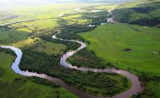
Rivers flowing into the Caspian Sea- 130 rivers flow into the Caspian Sea, of which 9 rivers have a mouth in the form of a delta. The major rivers flowing into the Caspian Sea are the Volga, Terek, Sulak, Samur (Russia), Ural, Emba (Kazakhstan), Kura (Azerbaijan), Atrek (Turkmenistan), Sefidrud (Iran) and others. largest river, which flows into the Caspian Sea - the Volga, its average annual drainage is 215-224 cubic kilometers. The Volga, Ural, Terek, Sulak and Emba provide up to 88-90% of the annual runoff to the Caspian Sea.
Physiography
Area, depth, volume of water- The area and volume of water in the Caspian Sea varies significantly depending on fluctuations in water levels. At a water level of -26.75 m, the area is approximately 371,000 square kilometers, the volume of water is 78,648 cubic kilometers, which is approximately 44% of the world's lake water reserves. The maximum depth of the Caspian Sea is in the South Caspian depression, 1025 meters from its surface level. In terms of maximum depth, the Caspian Sea is second only to Baikal (1620 m) and Tanganyika (1435 m). The average depth of the Caspian Sea, calculated from the bathygraphic curve, is 208 meters. At the same time, the northern part of the Caspian Sea is shallow, its maximum depth does not exceed 25 meters, and the average depth is 4 meters.
Water level fluctuations- The water level in the Caspian Sea is subject to significant fluctuations. According to modern science, over the past three thousand years, the magnitude of the change in the water level of the Caspian Sea has reached 15 meters. According to archeology and written sources, a high level of the Caspian Sea is recorded at the beginning of the 14th century. Instrumental measurement of the level of the Caspian Sea and systematic observations of its fluctuations have been carried out since 1837, during this time the highest water level was recorded in 1882 (−25.2 m), the lowest - in 1977 (−29.0 m), from In 1978, the water level rose and in 1995 it reached -26.7 m, since 1996 there has been a downward trend again. Scientists associate the causes of changes in the water level of the Caspian Sea with climatic, geological and anthropogenic factors. But in 2001, the sea level began to rise again, and reached -26.3 m.
Water temperature- water temperature is subject to significant latitudinal changes, most pronounced in winter, when the temperature changes from 0-0.5 °C at the ice edge in the north of the sea to 10-11 °C in the south, that is, the water temperature difference is about 10 ° C. For shallow water areas with depths less than 25 m, the annual amplitude can reach 25-26 °C. The average water temperature at west coast 1-2 °C higher than that of the eastern one, and in the open sea the water temperature is 2-4 °C higher than that of the coasts.
Water composition- the salt composition of the waters of the closed Caspian Sea differs from that of the ocean. There are significant differences in the ratios of the concentrations of salt-forming ions, especially for the waters of areas under the direct influence of continental runoff. The process of metamorphization of sea waters under the influence of continental runoff leads to a decrease in the relative content of chlorides in the total amount of salts in sea waters, an increase in the relative amount of carbonates, sulfates, and calcium, which are the main components in the chemical composition of river waters. The most conservative ions are potassium, sodium, chloride and magnesium. The least conservative are calcium and bicarbonate ion. In the Caspian Sea, the content of calcium and magnesium cations is almost two times higher than in the Sea of Azov, and sulfate anion is three times higher.
Bottom relief- the relief of the northern part of the Caspian Sea is a shallow wavy plain with banks and accumulative islands, the average depth of the Northern Caspian is 4-8 meters, the maximum does not exceed 25 meters. The Mangyshlak threshold separates the Northern Caspian from the Middle. The Middle Caspian is quite deep, the depth of water in the Derbent depression reaches 788 meters. The Apsheron threshold separates the Middle and South Caspian. The South Caspian is considered deep water, the depth of water in the South Caspian depression reaches 1025 meters from the surface of the Caspian Sea. Shell sands are common on the Caspian shelf, deep-water areas are covered with silty sediments, and in some areas there is an outcrop of bedrock.
Climate- The climate of the Caspian Sea is continental in the northern part, temperate in the middle part and subtropical in the southern part. In winter, the average monthly air temperature varies from -8…-10 in the northern part to +8…+10 in the southern part, in summer - from +24…+25 in the northern part to +26…+27 in the southern part. The maximum temperature of +44 degrees was recorded on the east coast. The average annual rainfall is 200 millimeters, ranging from 90-100 millimeters in the arid eastern part to 1,700 millimeters off the southwestern subtropical coast. Evaporation of water from the surface of the Caspian Sea is about 1000 millimeters per year, the most intense evaporation in the area of the Absheron Peninsula and in the eastern part of the South Caspian is up to 1400 millimeters per year. The average annual wind speed is 3-7 meters per second, the wind rose is dominated by northern winds. In the autumn and winter months, the winds increase, the wind speed often reaches 35-40 meters per second. The most windy areas are the Apsheron Peninsula, the environs of Makhachkala and Derbent, where the highest wave 11 meters high was also recorded.
currents- The circulation of waters in the Caspian Sea is connected with the runoff and winds. Since most of the water flow falls on the Northern Caspian, northern currents predominate. An intense northern current carries water from the Northern Caspian along the western coast to the Absheron Peninsula, where the current splits into two branches, one of which moves further along West Bank, the other goes to the Eastern Caspian.
Economic development of the Caspian Sea
Mining of oil and gas-Many oil and gas fields are being developed in the Caspian Sea. The proven oil resources in the Caspian Sea are about 10 billion tons, the total resources of oil and gas condensate are estimated at 18-20 billion tons. Oil production in the Caspian Sea began in 1820, when the first oil well was drilled on the Absheron shelf near Baku. In the second half of the 19th century, oil production began on an industrial scale on the Absheron Peninsula, and then on other territories. In 1949, Oil Rocks for the first time began to extract oil from the bottom of the Caspian Sea. So, on August 24 of this year, the team of Mikhail Kaverochkin started drilling a well, which on November 7 of the same year gave the long-awaited oil. In addition to oil and gas production, salt, limestone, stone, sand, and clay are also mined on the coast of the Caspian Sea and the Caspian shelf.
Shipping- Shipping is developed in the Caspian Sea. Ferry crossings operate on the Caspian Sea, in particular, Baku - Turkmenbashi, Baku - Aktau, Makhachkala - Aktau. The Caspian Sea has a navigable connection with Sea of Azov through the rivers Volga, Don and the Volga-Don Canal.
Fishing and seafood-fishing (sturgeon, bream, carp, pike perch, sprat), caviar production, as well as seal fishing. More than 90 percent of the world's sturgeon catch is carried out in the Caspian Sea. In addition to industrial production, illegal production of sturgeon and their caviar flourishes in the Caspian Sea.
Legal status of the Caspian Sea- after the collapse of the USSR, the division of the Caspian Sea for a long time was and still remains the subject of unsettled disagreements related to the division of the resources of the Caspian shelf - oil and gas, as well as biological resources. For a long time there were negotiations between the Caspian states on the status of the Caspian Sea - Azerbaijan, Kazakhstan and Turkmenistan insisted on dividing the Caspian along the median line, Iran - on dividing the Caspian along one fifth between all the Caspian states. The current legal regime of the Caspian is established by the Soviet-Iranian treaties of 1921 and 1940. These treaties provide for freedom of navigation throughout the sea, freedom of fishing, with the exception of ten-mile national fishing zones, and a ban on navigation in its waters of ships flying the flag of non-Caspian states. Negotiations on the legal status of the Caspian are currently ongoing.
, Kura
42° N sh. 51° E d. HGIOLCaspian Sea- the largest enclosed body of water on Earth, which can be classified as the largest drainless lake, or as a full-fledged sea, due to its size, and also due to the fact that its bed is composed of an oceanic type of earth's crust. Located at the crossroads of Europe and Asia. The water in the Caspian is brackish, - from 0.05 ‰ near the mouth of the Volga to 11-13 ‰ in the southeast. The water level is subject to fluctuations, according to 2009 data it was 27.16 m below sea level. The area of the Caspian Sea is currently approximately 371,000 km², the maximum depth is 1025 m.
Encyclopedic YouTube
1 / 5
✪ Dagestan. Caspian Sea.
✪ Kazakhstan. Aktau. The beaches of the Caspian Sea and hellish thorns for bicycles. Series 1
✪ Environmental risks in oil production in the Caspian Sea
✪ 🌊Vlog / CASPIAN SEA / Aktau / NEW EMBANKMENT🌊
✪ #2 Iran. How tourists are scammed. Local kitchen. Caspian Sea
Subtitles
Etymology
Geographical position
The Caspian Sea is located at the crossroads of Europe and Asia. The length of the sea from north to south is approximately 1200 kilometers (36 ° 34 "-47 ° 13" N), from west to east - from 195 to 435 kilometers, on average 310-320 kilometers (46 ° -56 ° in d.).
According to the physical and geographical conditions, the Caspian Sea is conditionally divided into three parts - the North Caspian (25% of the sea area), the Middle Caspian (36%) and the South Caspian (39%). The conditional border between the North and Middle Caspian runs along the line Chechen Island - Cape Tyub-Karagan, between the Middle and South Caspian - along the line Chilov Island - Cape Gan-Gulu.
Coast
The territory adjacent to the Caspian Sea is called the Caspian Sea.
peninsulas
- Absheron peninsula, located on the western coast of the Caspian in the territory of Azerbaijan, at the northeastern end of the Greater Caucasus, the cities of Baku and Sumgayit are located on its territory
- Mangyshlak, located on the east coast of the Caspian Sea, on the territory of Kazakhstan, on its territory is the city of Aktau
Islands
There are about 50 large and medium-sized islands in the Caspian Sea with a total area of approximately 350 square kilometers.
The largest islands:
gulfs
Major bays:
Kara-Bogaz-Gol
At east coast there is a salt lake Kara-Bogaz-Gol, which until 1980 was a bay-lagoon of the Caspian Sea, connected to it by a narrow strait. In 1980, a dam was built separating Kara-Bogaz-Gol from the Caspian Sea, in 1984 a culvert was built, after which the level of Kara-Bogaz-Gol dropped by several meters. In 1992, the strait was restored, through which water leaves the Caspian Sea to Kara-Bogaz-Gol and evaporates there. Every year, 8-10 cubic kilometers of water (according to other sources - 25 cubic kilometers) and about 15 million tons of salt enter Kara-Bogaz-Gol from the Caspian Sea.
Rivers flowing into the Caspian Sea
130 rivers flow into the Caspian Sea, of which 9 rivers have a mouth in the form of a delta. The major rivers flowing into the Caspian Sea are the Volga, Terek, Sulak, Samur (Russia), Ural, Emba (Kazakhstan), Kura (Azerbaijan), Atrek (Turkmenistan), Sefidrud (Iran). The largest river flowing into the Caspian Sea is the Volga, its average annual runoff is 215-224 cubic kilometers. The Volga, Ural, Terek, Sulak and Emba provide up to 88-90% of the annual runoff to the Caspian Sea.
Caspian Sea Basin
coastal states
According to the Intergovernmental Economic Conference of the Caspian States:
The Caspian Sea washes the shores of five coastal states:
Cities on the coast of the Caspian Sea
On the Russian coast there are cities - Lagan, Makhachkala, Kaspiysk, Izberbash, Dagestan Lights and the most Southern City Russian Derbent. Astrakhan is also considered a port city of the Caspian Sea, which, however, is not located on the shores of the Caspian Sea, but in the Volga delta, 60 kilometers from the northern coast of the Caspian Sea.
Physiography
Area, depth, volume of water
The area and volume of water in the Caspian Sea varies significantly depending on fluctuations in water levels. At a water level of -26.75 m, the area is approximately 371,000 square kilometers, the volume of water is 78,648 cubic kilometers, which is approximately 44% of the world's lake water reserves. The maximum depth of the Caspian Sea is in the South Caspian depression, 1025 meters from its surface level. In terms of maximum depth, the Caspian Sea is second only to Baikal (1620 m) and Tanganyika (1435 m). The average depth of the Caspian Sea, calculated from the bathygraphic curve, is 208 meters. At the same time, the northern part of the Caspian Sea is shallow, its maximum depth does not exceed 25 meters, and the average depth is 4 meters.
Water level fluctuations
Vegetable world
The flora of the Caspian Sea and its coast is represented by 728 species. Of the plants in the Caspian Sea, algae predominate - blue-green, diatoms, red, brown, char and others, of flowering - zoster and ruppia. By origin, the flora refers mainly to the Neogene age, however, some plants were brought into the Caspian Sea by man consciously, or on the bottoms of ships.
Story
Origin
The Caspian Sea is of oceanic origin - its bed is composed of an oceanic type of earth's crust. 13 million liters n. the formed Alps separated the Sarmatian Sea from the Mediterranean. 3.4 - 1.8 million liters. n. (Pliocene) there was the Akchagyl Sea, the deposits of which were studied by N. I. Andrusov. It was originally formed on the site of the dried up Pontic Sea, from which Lake Balakhani remained (on the territory of the southern Caspian). The Akchagyl transgression was replaced by the Domashkino regression (falling by 20-40 m from the level of the Akchagyl basin), accompanied by a strong desalination of sea waters, which was due to the cessation of the inflow of sea (oceanic) waters from outside. After a short Domashkino regression at the beginning of the Quaternary period (Eopleistocene), the Caspian is almost restored in the form of the Apsheron Sea, which covers the Caspian and floods the territories of Turkmenistan and the Lower Volga region. At the beginning of the Apsheron transgression, the basin turns into a brackish water reservoir. The Absheron Sea existed from 1.7 to 1 million years ago. The beginning of the Pleistocene in the Caspian was marked by a long and deep Turkyan regression (-150 m to -200 m), corresponding to the Matuyama-Brunhes magnetic reversal (0.8 Ma). The water mass of the Turkyan basin with an area of 208 thousand km² was concentrated in the South Caspian and part of the Middle Caspian basins, between which there was a shallow strait in the area of the Apsheron threshold. In the early Neopleistocene, after the Turkyan regression, there were isolated Early Baku and Late Baku basins with a runoff (level up to 20 m) (about 400 thousand years ago). The Vened (Mishovdag) regression separated the Baku and Urundzhik (Middle Neopleistocene, up to −15 m) transgressions at the end of the Early - the beginning of the Late Pleistocene (basin area - 336 thousand km²). Between the marine Urundzhik and Khazar deposits, a large deep Cheleken regression (up to −20 m) was noted, corresponding to the optimum of the Likhvin interglacial (350-300 thousand years ago). In the middle Neopleistocene, there were basins: early Khazar early (200 thousand years ago), early Khazar middle (level up to 35-40 m) and early Khazar late. In the Late Pleistocene, there was an isolated Late Khazar basin (level up to −10 m, 100 thousand years ago), after which a small Chernoyarsk regression of the second half - the end of the Middle Pleistocene occurred (thermoluminescent dates 122-184 thousand years ago), in in turn, replaced by the Hyrkanian (Gyurgyan) basin.
The deep long-term Atelian regression of the middle of the late Pleistocene at the initial stage had a level of -20 - -25 m, at the maximum stage -100 - -120 m, at the third stage - -45 - -50 m. At the maximum, the basin area is reduced to 228 thousand km² . After atelier regression (−120 - −140 m), approx. 17 thousand liters n. the early Khvalynian transgression began - up to + 50 m (the Manych-Kerch Strait functioned), which was interrupted by the Elton regression. The Early Khvalynsk II basin (level up to 50 m) was replaced at the beginning of the Holocene by a short-term Enotaev regression (from −45 to −110 m), coinciding in time with the end of the Preboreal and the beginning of the Boreal. The Enotaevka regression was replaced by the late Khvalynian transgression (0 m). The Late Khvalynian transgression was replaced in the Holocene (about 9-7 thousand years ago or 7.2-6.4 thousand years ago) by the Mangyshlak regression (from −50 to −90 m). The Mangyshlak regression was replaced in the first phase of interglacial cooling and moistening (Atlantic period) by the New Caspian transgression. The Novo-Caspian basin was brackish (11-13‰), warm-water and isolated (level up to −19 m). At least three cycles of transgressive-regressive phases have been recorded in the development of the New Caspian basin. The Dagestan (Gousan) transgression previously belonged to the initial stage of the New Caspian epoch, but the absence of the leading New Caspian form in its sediments Cerastoderma glaucum (cardium edule) gives grounds for separating it into an independent transgression of the Caspian. The Izberbash regression, separating the Dagestan and New Caspian transgressions of the Caspian proper, occurred in the interval between 4.3 and 3.9 thousand years ago. Judging by the structure of the Turali section (Dagestan) and radiocarbon analysis data, transgressions were noted twice - about 1900 and 1700 years ago.
Anthropological and cultural history of the Caspian Sea
Shipping
Shipping is developed in the Caspian Sea. Ferry crossings operate on the Caspian Sea, in particular, Baku - Turkmenbashi, Baku - Aktau, Makhachkala - Aktau. The Caspian Sea has a navigable connection with the Sea of Azov through the rivers Volga, Don and the Volga-Don Canal.
Fishing and seafood
Fishing (sturgeon, bream, carp, pike perch, sprat), caviar production, as well as seal fishing. More than 90 percent of the world's sturgeon catch is carried out in the Caspian Sea. In addition to industrial production, illegal production of sturgeons and their caviar flourishes in the Caspian Sea.
Recreational resources
The natural environment of the Caspian coast with sandy beaches, mineral waters and therapeutic mud in the coastal zone creates good conditions for rest and treatment. At the same time, in terms of the degree of development of resorts and the tourism industry, the Caspian coast noticeably loses to the Black Sea coast of the Caucasus. At the same time, in recent years, the tourism industry has been actively developing on the coast of Azerbaijan, Iran, Turkmenistan and Russian Dagestan. Azerbaijan is actively developing resort area in the Baku region. At the moment, a world-class resort has been created in Amburan, another modern tourist complex is being built near the village of Nardaran, recreation in the sanatoriums of the villages of Bilgah and Zagulba is very popular. A resort area is also being developed in Nabran, in northern Azerbaijan. However, high prices, a generally low level of service and a lack of advertising lead to Caspian resorts almost no foreign tourists. The development of the tourism industry in Turkmenistan is hampered by a long policy of isolation, in Iran - by Sharia law, due to which the mass vacation of foreign tourists on the Caspian coast of Iran is impossible.
Ecological problems
The environmental problems of the Caspian Sea are associated with water pollution as a result of oil production and transportation on the continental shelf, the flow of pollutants from the Volga and other rivers flowing into the Caspian Sea, the vital activity of coastal cities, as well as the flooding of individual objects due to the rise in the level of the Caspian Sea. Predatory harvesting of sturgeons and their caviar, rampant poaching lead to a decrease in the number of sturgeons and forced restrictions on their production and export.
Legal status
After the collapse of the USSR, the division of the Caspian Sea has long been and still remains the subject of unsettled disagreements related to the division of the resources of the Caspian shelf - oil and gas, as well as biological resources. For a long time there were negotiations between the Caspian states on the status of the Caspian Sea - Azerbaijan, Kazakhstan and Turkmenistan insisted on dividing the Caspian along the median line, Iran - on dividing the Caspian along one fifth between all the Caspian states.
With regard to the Caspian Sea, the key is the physical and geographical circumstance that it is a closed inland water body that does not have a natural connection with the World Ocean. Accordingly, the norms and concepts of international maritime law, in particular, the provisions of the 1982 UN Convention on the Law of the Sea, should not automatically apply to the Caspian Sea. Based on this, it would be unlawful to apply such concepts as “territorial sea”, “exclusive economic zone”, “continental shelf”, etc. to the Caspian Sea.
The current legal regime of the Caspian Sea was established by the Soviet-Iranian treaties of 1921 and 1940. These treaties provide for freedom of navigation throughout the sea, freedom of fishing, with the exception of ten-mile national fishing zones, and a ban on navigation in its waters of ships flying the flag of non-Caspian states.
Negotiations on the legal status of the Caspian are currently ongoing.
Delimitation of sections of the bottom of the Caspian Sea for the purpose of subsoil use
The Russian Federation concluded an agreement with Kazakhstan on the delimitation of the bottom of the northern part of the Caspian Sea in order to exercise sovereign rights to subsoil use (dated July 6, 1998 and the Protocol dated May 13, 2002), an agreement with Azerbaijan on the delimitation of adjacent sections of the bottom of the northern part of the Caspian Sea (dated September 23, 2002), as well as the trilateral Russian-Azerbaijani-Kazakhstan agreement on the junction of the demarcation lines of adjacent sections of the Caspian Sea bottom (dated May 14, 2003), which established geographical coordinates dividing lines delimiting seabed areas within which the parties exercise their sovereign rights in the field of exploration and production of mineral resources.
The Caspian Sea is located on the border of Europe and Asia and is surrounded by the territories of five states: Russia, Azerbaijan, Iran, Turkmenistan and Kazakhstan. Despite the name, the Caspian is the largest lake on the planet (its area is 371,000 km2), but the bottom, composed of oceanic crust, and salty water Together with its large size, they give reason to consider it a sea. A large number of rivers flow into the Caspian Sea, for example, such large ones as the Volga, Terek, Ural, Kura and others.
Relief and depth of the Caspian Sea
According to the bottom relief, the Caspian Sea is divided into three parts: southern (the largest and deepest), middle and northern.
In the northern part, the depth of the sea is the smallest: on average, it is from four to eight meters, and the maximum depth here reaches 25 m. The northern part of the Caspian Sea is limited by the Mangyshlak Peninsula and occupies 25% of the entire area of the reservoir.

The middle part of the Caspian is deeper. Here the average depth becomes equal to 190 m, while the maximum is 788 meters. The area of the middle Caspian is 36% of the total, and the volume of water is 33% of the total volume of the sea. It is separated from the southern part by the Absheron Peninsula in Azerbaijan.
The deepest and largest part of the Caspian Sea is the southern one. It takes 39% total area, and its share of the total volume of water is 66%. Here is the South Caspian depression, in which the deepest point of the sea is located - 1025 m.
Islands, peninsulas and bays of the Caspian Sea
In total, there are about 50 islands in the Caspian Sea, almost all of them are uninhabited. Due to the shallower depth of the northern part of the sea, most of the islands are located there, among them the Baku archipelago belonging to Azerbaijan, the Seal Islands in Kazakhstan, as well as many Russian islands off the coast Astrakhan region and Dagestan.
Among the peninsulas of the Caspian Sea, the largest are Mangyshlak (Mangistau) in Kazakhstan and Absheron in Azerbaijan, where such large cities as the country's capital Baku and Sumgayit are located.
Gulf of Kara-Bogaz-Gol Caspian Sea

The coastline of the sea is heavily indented, and there are many bays on it, for example, Kizlyar, Mangyshlak, Dead Kultuk and others. Special mention deserves the Kara-Bogaz-Gol Bay, which is actually a separate lake connected to the Caspian Sea by a narrow strait, thanks to which a separate ecosystem and higher salinity of water are preserved in it.
Fishing in the Caspian Sea
Since ancient times, the Caspian Sea has attracted the inhabitants of its shores with its fish resources. About 90% of the world's sturgeon production is mined here, as well as such fish as carp, bream, and sprat.

Caspian Sea video
In addition to fish, the Caspian is extremely rich in oil and gas, the total reserves of which are about 18-20 million tons. Salt, limestone, sand and clay are also mined here.
If you liked this material, share it with your friends on social networks. Thank you!
Until now, there are disputes about the status of the Caspian Sea. The fact is that, despite its common name, it is still the largest endorheic lake in the world. It was called the sea because of the features that the structure of the bottom has. It is formed by oceanic crust. In addition, the water in the Caspian Sea is salty. As at sea, storms and strong winds are often observed here, raising high waves.
Geography
The Caspian Sea is located at the crossroads of Asia and Europe. In its shape, it resembles one of the letters of the Latin alphabet - S. From south to north, the sea stretches for 1200 km, and from east to west - from 195 to 435 km.
The territory of the Caspian Sea is heterogeneous in terms of its physical and geographical conditions. In this regard, it is conventionally divided into 3 parts. These include the Northern and Middle, as well as the Southern Caspian.
coastal countries
Which countries are washed by the Caspian Sea? There are only five of them:
- Russia, located in the northwest and west. The length of the coastline of this state along the Caspian Sea is 695 km. Kalmykia, Dagestan and the Astrakhan region, which are part of Russia, are located here.
- Kazakhstan. This is a country on the shores of the Caspian Sea, located in the east and northeast. The length of its coastline is 2320 km.
- Turkmenistan. The map of the Caspian states indicates that this country is located in the southeast of the water basin. The length of the line along the coast is 1200 km.
- Azerbaijan. This state, stretching along the Caspian for 955 km, washes its shores in the southwest.
- Iran. The map of the Caspian states indicates that this country is located near southern shores drainless lake. At the same time, the length of its sea borders is 724 km.
Caspian sea?
Until now, the dispute about how to name this unique reservoir has not been resolved. And it is important to answer this question. The fact is that all countries on the Caspian Sea have their own interests in this region. However, the question of how to divide this huge body of water, the governments of the five states have not been able to decide for a long time. The main dispute revolved around the name. Is the Caspian still a sea or a lake? Moreover, the answer to this question is more of interest to non-geographers. First of all, politicians need it. This is due to the application of international law.

Caspian states such as Kazakhstan and Russia believe that their borders in this region are washed by the sea. In this regard, representatives of the two indicated countries insist on the application of the UN Convention, adopted in 1982. It concerns the law of the sea. The provisions of this document state that the coastal states are assigned a twelve-mile water zone along it. In addition, the country is granted the right to an economic maritime territory. It is located at a distance of two hundred miles. The coastal state also has the right to, however, even the widest part of the Caspian Sea is narrower than the distance specified in the international document. In such a case, the principle of the median line can be applied. At the same time, the Caspian states, which have the largest length of coastal borders, will receive a large sea area.
Iran has a different opinion on this matter. Its representatives believe that the Caspian should be divided fairly. In this case, all countries will get twenty percent of the sea area. One can understand the position of official Tehran. With such a solution to the problem, the state will control a larger zone than when dividing the sea along the median line.

However, the Caspian from year to year significantly changes its water level. This does not allow determining its median line and dividing the territory between states. Countries such as Azerbaijan, Kazakhstan and Russia have signed an agreement among themselves defining those bottom zones on which the parties will exercise their economic rights. Thus, a certain legal truce has been achieved in the northern territories of the sea. Southern countries The Caspian Sea has not yet come to a unified decision. At the same time, they do not recognize the agreements reached by their northern neighbors.
The Caspian is a lake?
Adherents of this point of view proceed from the fact that the reservoir, located at the junction of Asia and Europe, is closed. In this case, it is impossible to apply the document on the norms of international maritime law to it. Supporters of this theory are convinced that they are right, referring to the fact that the Caspian Sea has no natural connection with the waters of the World Ocean. But here another difficulty arises. If the lake is the Caspian Sea, the borders of states according to what international standards should be determined on its water spaces? Unfortunately, such documents have not yet been developed. The fact is that the issues of the international lake were not discussed anywhere and by anyone.
Is the Caspian a unique body of water?
In addition to those listed above, there is another, third point of view on the ownership of this amazing reservoir. Its supporters are of the opinion that the Caspian should be recognized as an international water basin, belonging equally to all countries bordering on it. In their opinion, the resources of the region are subject to joint exploitation by the countries bordering the reservoir.
Solving Security Issues
The Caspian states are doing everything possible to eliminate all existing differences. And there are positive developments in this regard. One of the steps towards solving problems related to the Caspian region was an agreement signed on November 18, 2010 between all five countries. It concerns issues of cooperation in the field of security. In this document, the countries agreed on joint activities to eliminate terrorism, drug trafficking, smuggling, poaching, money laundering, etc. in the region.
environmental protection
Particular attention is paid to solving environmental issues. The territory on which the Caspian states and Eurasia are located is a region under the threat of industrial pollution. Kazakhstan, Turkmenistan and Azerbaijan are dumping waste from exploration and production of energy carriers into the waters of the Caspian Sea. Moreover, it is in these countries that a large number of abandoned oil wells are located, which are not operated because of their unprofitability, but nevertheless continue to have an adverse impact on the environmental situation. As for Iran, it dumps waste into sea waters Agriculture and stocks. Russia threatens the ecology of the region with industrial pollution. It's connected with economic activity deployed in the Volga region.

The countries on the Caspian Sea have made some progress in solving environmental problems. Thus, since August 12, 2007, the Framework Convection has been in force in the region, which sets itself the goal of protecting the Caspian Sea. This document developed provisions on the protection of bioresources and the regulation of anthropogenic factors affecting the aquatic environment. According to this convection, the parties must cooperate in carrying out activities to improve the environmental situation in the Caspian.

In 2011 and 2012, all five countries also signed other documents significant for the protection of the marine environment. Among them:
- Protocol on Cooperation, Response and Regional Preparedness for Oil Pollution Events.
- Protocol concerning the protection of the region against pollution from land-based sources.
Development of the gas pipeline construction
To date, another problem is unresolved in the Caspian region. It concerns the laying This idea is an important strategic task of the West and the United States, which continue to look for sources of energy resources alternative to Russian ones. That is why, when resolving this issue, the parties do not turn to such countries as Kazakhstan, Iran and, of course, the Russian Federation. Brussels and Washington supported the statement made in Baku on November 18, 2010 at the summit of the heads of the Caspian countries. He expressed the official position of Ashgabat regarding the laying of the pipeline. The Turkmen authorities believe that the project should be carried out. At the same time, only those states, on the territories of the bottom of which it will be located, must give their consent to the construction of the pipeline. These are Turkmenistan and Azerbaijan. Iran and Russia opposed this position and the project itself. At the same time, they were guided by the issues of protecting the Caspian ecosystem. To date, the construction of the pipeline is not being carried out due to disagreement between the project participants.
Hosting the first summit
The countries on the Caspian Sea are constantly looking for ways to solve the problems that have matured in this Eurasian region. For this, special meetings of their representatives are organized. Thus, the first summit of the heads of the Caspian states took place in April 2002. Ashgabat became its venue. However, the results of this meeting did not meet expectations. The summit was considered unsuccessful due to Iran's demands for the division of the sea into 5 equal parts. This was strongly opposed by other countries. Their representatives defended their own point of view that the size of national water areas should correspond to the length that the coastline of the state has.

The failure of the summit was also provoked by a dispute between Ashgabat and Baku over the ownership of three oil fields located in the center of the Caspian Sea. As a result, the heads of the five states did not develop a unanimous opinion on any of all the issues raised. However, at the same time, an agreement was reached to hold a second summit. It was supposed to take place in 2003 in Baku.
Second Caspian Summit
Despite the existing agreements, the scheduled meeting was postponed every year. The heads of the Caspian littoral states gathered for the second summit only on October 16, 2007. The venue was Tehran. At the meeting, topical issues related to determining the legal status of a unique reservoir, which is the Caspian Sea, were discussed. The borders of the states within the framework of the division of the water area were preliminarily agreed during the development of the draft of the new convention. Issues of security, ecology, economy and cooperation were also raised. coastal countries. In addition, the results of the work that the states have carried out since the first summit were summed up. In Tehran, representatives of the five states also outlined ways for further cooperation in the region.
Meeting at the third summit
Once again, the heads of the Caspian countries met in Baku on November 18, 2010. The result of this summit was the signing of an agreement on expanding cooperation regarding security issues. During the meeting, it was pointed out that which countries werehes the Caspian Sea, only those should ensure the fight against terrorism, transnational crime, weapons proliferation, etc.
Fourth summit
Once again, the Caspian states raised their problems in Astrakhan on September 29, 2014. At this meeting, the presidents of the five countries signed another statement.

In it, the parties fixed the exclusive right of the coastal countries to deploy armed forces in the Caspian. But even at this meeting, the status of the Caspian was not finally settled.
The Caspian Sea is inland and is located in a vast continental depression on the border of Europe and Asia. The Caspian Sea has no connection with the ocean, which formally allows it to be called a lake, but it has all the features of the sea, since it had connections with the ocean in past geological epochs.
The area of the sea is 386.4 thousand km2, the volume of water is 78 thousand m3.
The Caspian Sea has a vast drainage basin, with an area of about 3.5 million km2. The nature of landscapes, climatic conditions and types of rivers are different. Despite its vastness, only 62.6% of its area is in waste areas; about 26.1% - for drainless. The area of the Caspian Sea itself is 11.3%. 130 rivers flow into it, but almost all of them are located in the north and west (and the eastern coast does not have a single river reaching the sea at all). The largest river in the Caspian basin is the Volga, which provides 78% of the river water entering the sea (it should be noted that more than 25% of the Russian economy is located in the basin of this river, and this undoubtedly determines many other features of the waters of the Caspian Sea), as well as the Kura River , Zhaiyk (Ural), Terek, Sulak, Samur.
Physically and geographically, the sea is divided into three parts: northern, middle and southern. The conditional boundary between the northern and middle parts runs along the line of Chechen Island–Cape Tyub-Karagan, between the middle and southern parts - along the line of Zhiloy Island–Cape Kuuli.
The shelf of the Caspian Sea, on average, is limited to depths of about 100 m. The continental slope, which begins below the edge of the shelf, ends in the middle part at about 500–600 m, in the southern part, where it is very steep, at 700–750 m.
The northern part of the sea is shallow, its average depth is 5–6 m, the maximum depths of 15–20 m are located on the border with the middle part of the sea. The bottom relief is complicated by the presence of banks, islands, furrows.
The middle part of the sea is a separate basin, the region of maximum depths of which - Derbent - is shifted to the western coast. The average depth of this part of the sea is 190 m, the greatest is 788 m.

The southern part of the sea is separated from the middle part by the Apsheron threshold, which is a continuation of . The depths above this underwater ridge do not exceed 180 m. deep water The South Caspian depression with a maximum sea depth of 1025 m is located east of the Kura delta. Several underwater ridges up to 500 m high rise above the bottom of the basin.
The shores of the Caspian Sea are diverse. In the northern part of the sea, they are quite strongly indented. Here are the bays of Kizlyar, Agrakhan, Mangyshlak and many shallow bays. Notable peninsulas: Agrakhansky, Buzachi, Tyub-Karagan, Mangyshlak. Large islands in the northern part of the sea are Tyuleniy, Kulaly. In the deltas of the Volga and Ural rivers, the coastline is complicated by many islets and channels, which often change their position. Many small islands and banks are located on other parts of the coastline.
The middle part of the sea has a relatively flat coastline. On the west coast, on the border with southern part Sea is the Absheron Peninsula. To the east of it, the islands and banks of the Apsheron archipelago stand out, of which the most large island Residential. The eastern shore of the Middle Caspian is more indented, the Kazakh Bay stands out here with the Kenderli Bay and several capes. The largest bay of this coast is.

South of the Absheron Peninsula are the islands of the Baku archipelago. The origin of these islands, as well as some banks off the eastern coast of the southern part of the sea, is associated with the activity of underwater mud volcanoes lying at the bottom of the sea. On the eastern shore are the large bays of Turkmenbashi and Turkmensky, and near it is the island of Ogurchinsky.
One of the most striking phenomena of the Caspian Sea is the periodic variability of its level. In historical times, the Caspian Sea had a lower level than the World Ocean. Fluctuations in the level of the Caspian Sea are so great that for more than a century they have attracted the attention of not only scientists. Its peculiarity is that in the memory of mankind its level has always been below the level of the World Ocean. Since the beginning of instrumental observations (since 1830) of the sea level, the amplitude of its fluctuations has been almost 4 m, from -25.3 m in the eighties of the XIX century. to -29 m in 1977. In the last century, the level of the Caspian Sea has changed significantly twice. In 1929 it stood at a mark of about -26 m, and since it had been close to this mark for almost a century, this position of the level was considered as a long-term or secular average. In 1930, the level began to decline rapidly. Already by 1941, it had dropped by almost 2 m. This led to the drying up of vast coastal areas of the bottom. The decrease in the level, with its small fluctuations (short-term insignificant rises in the level in 1946-1948 and 1956-1958), continued until 1977 and reached the mark of -29.02 m, i.e., the level took the lowest position for last 200 years.

In 1978, contrary to all forecasts, the sea level began to rise. As of 1994, the level of the Caspian Sea was at -26.5 m, that is, in 16 years the level has risen by more than 2 m. The rate of this rise is 15 cm per year. The level increment in some years was higher, and in 1991 it reached 39 cm.
The general fluctuations in the level of the Caspian Sea are superimposed by its seasonal changes, the average long-term of which reaches 40 cm, as well as surge phenomena. The latter are especially pronounced in the Northern Caspian. The northwestern coast is characterized by large surges created by the prevailing, especially in the cold season, storms of eastern and southeastern directions. Over the past decades, a number of large (more than 1.5–3 m) surges have been observed here. A particularly large surge with catastrophic consequences was noted in 1952. Fluctuations in the level of the Caspian Sea cause great damage to the states surrounding its water area.


Climate. The Caspian Sea is located in temperate and subtropical. Climatic conditions change in the meridional direction, since the sea stretches for almost 1200 km from north to south.
In the Caspian region, various circulation systems interact, however, easterly winds prevail throughout the year (the influence of the Asian high). The position in rather low latitudes provides a positive balance of heat inflow, so the Caspian Sea serves as a source of heat and moisture for most of the year for those passing by. The average annual temperature in the northern part of the sea is 8–10°С, in the middle part - 11–14°С, in the southern part – 15–17°С. However, in the northernmost parts of the sea, the average January temperature is from –7 to –10°C, and the minimum during intrusions is up to –30°C, which causes the formation ice cover. In summer, rather high temperatures dominate over the entire region under consideration - 24–26°С. Thus, the Northern Caspian is subject to the most sharp temperature fluctuations.
The Caspian Sea is characterized by a very small amount of precipitation per year - only 180 mm, and most of it falls on the cold season of the year (from October to March). However, the Northern Caspian differs in this respect from the rest of the basin: here the average annual precipitation is less (only 137 mm for the western part), and the distribution over the seasons is more even (10–18 mm per month). In general, we can talk about proximity to arid ones.
Water temperature. Distinctive features of the Caspian Sea (large differences in depths in different parts of the sea, nature, isolation) have a certain influence on the formation of temperature conditions. In the shallow North Caspian, the entire water column can be considered as homogeneous (the same applies to shallow bays located in other parts of the sea). In the Middle and South Caspian, surface and deep masses separated by a transitional layer can be distinguished. In the Northern Caspian and in the surface layers of the Middle and Southern Caspian, the water temperature varies over a wide range. In winter, temperatures vary from north to south from less than 2 to 10°С, the water temperature near the western coast is 1–2°С higher than near the eastern one, in the open sea the temperature is higher than near the coasts: by 2–3°С in the middle part and by 3–4°С in the southern part of the sea. In winter, the temperature distribution is more uniform with depth, which is facilitated by the winter vertical circulation. During moderate and severe winters in the northern part of the sea and shallow bays on the east coast, the water temperature drops to freezing.

In summer, the temperature varies in space from 20 to 28°C. The highest temperatures are observed in the southern part of the sea; temperatures are also quite high in the well-warmed shallow North Caspian. The zone of distribution of the lowest temperatures is adjacent to the east coast. This is due to the rise of cold deep waters to the surface. Temperatures are also relatively low in the poorly heated deep-water central part. IN open areas sea in late May–early June, the formation of a temperature jump layer begins, which is most clearly expressed in August. Most often it is located between 20 and 30 m in the middle part of the sea and 30 and 40 m in the south. In the middle part of the sea, due to the surge near the eastern coast, the shock layer rises close to the surface. In the bottom layers of the sea, the temperature during the year is about 4.5°C in the middle part and 5.8–5.9°C in the south.
Salinity. Salinity values are determined by such factors as river runoff, water dynamics, including mainly wind and gradient currents, the resulting water exchange between the western and eastern parts of the North Caspian and between the North and Middle Caspian, the bottom topography, which determines the location of waters with different , mainly along the isobaths, evaporation, which ensures the deficit fresh water and the influx of more salty. These factors collectively affect the seasonal differences in salinity.
The Northern Caspian can be viewed as a constant mixture of river and Caspian waters. The most active mixing occurs in the western part, where both river and Central Caspian waters directly enter. In this case, horizontal salinity gradients can reach 1‰ per 1 km.
The eastern part of the Northern Caspian is characterized by a more uniform salinity field, since most of the river and sea (Middle Caspian) waters enter this area of the sea in a transformed form.

According to the values of horizontal salinity gradients, in the western part of the Northern Caspian, a river-sea contact zone can be distinguished with water salinity from 2 to 10‰, in the eastern part from 2 to 6‰.
Significant vertical salinity gradients in the Northern Caspian are formed as a result of the interaction of river and sea waters, with runoff playing a decisive role. The intensification of vertical stratification is also facilitated by the unequal thermal state of the water layers, since the temperature of the surface desalinated waters coming from the coast in summer is 10–15°C higher than that of the bottom ones.
In the deep basins of the Middle and South Caspian, salinity fluctuations in the upper layer are 1–1.5‰. The largest difference between the maximum and minimum salinity was noted in the area of the Apsheron threshold, where it is 1.6‰ in the surface layer and 2.1‰ at the 5 m horizon.
The decrease in salinity along the western coast of the South Caspian in the 0–20 m layer is caused by the runoff of the Kura River. The influence of the Kura runoff decreases with depth; at the horizons of 40–70 m, the range of salinity fluctuations is no more than 1.1‰. Along the entire western coast to the Absheron Peninsula stretches a strip of desalinated water with a salinity of 10–12.5‰ coming from the Northern Caspian.
In addition, salinity increases in the South Caspian due to the removal of saline waters from bays and inlets on the eastern shelf under the action of southeasterly winds. In the future, these waters are transferred to the Middle Caspian.
In the deep layers of the Middle and South Caspian, salinity is about 13‰. In the central part of the Middle Caspian, such salinity is observed at horizons below 100 m, and in the deep part of the South Caspian, the upper boundary of waters with increased salinity drops to 250 m. Obviously, vertical mixing of waters is difficult in these parts of the sea.
Surface water circulation. Currents in the sea are mainly wind-driven. In the western part of the Northern Caspian, currents of the western and eastern quarters are most often observed, in the eastern - southwestern and southern. The currents caused by the runoff of the Volga and Ural rivers can be traced only within the estuarine coast. The prevailing current velocities are 10–15 cm/s; in the open areas of the Northern Caspian, the maximum velocities are about 30 cm/s.
In the coastal areas of the middle and southern parts of the sea, currents of the northwestern, northern, southeastern, and southern directions are observed in accordance with the wind directions; eastward currents often occur near the eastern coast. Along the western coast of the middle part of the sea, the most stable currents are southeast and south. Current velocities are on average about 20–40 cm/s, the maximum ones reach 50–80 cm/s. Other types of currents also play a significant role in the circulation of sea waters: gradient, seiche, inertial ones.

ice formation. The Northern Caspian is covered with ice annually in November, the area of the freezing part of the water area depends on the severity of the winter: in severe winters, the entire Northern Caspian is covered with ice, in soft ice it stays within the 2–3 meter isobath. The appearance of ice in the middle and southern parts of the sea falls on December-January. Near the eastern coast, ice is of local origin, near the western coast - most often brought from the northern part of the sea. In severe winters, shallow bays freeze off the eastern coast of the middle part of the sea, coasts and landfast ice form off the coast, and drift ice spreads to the Absheron Peninsula in abnormally cold winters off the western coast. The disappearance of the ice cover is observed in the second half of February–March.
Oxygen content. The spatial distribution of dissolved oxygen in the Caspian Sea has a number of regularities.
The central part of the Northern Caspian is characterized by a fairly uniform distribution of oxygen. An increased oxygen content is found in the areas of the pre-estuary seashore of the Volga River, a lower one - in the southwestern part of the Northern Caspian.
In the Middle and South Caspian, the highest oxygen concentrations are confined to coastal shallow areas and pre-estuary seashores of rivers, with the exception of the most polluted areas of the sea (Baku Bay, Sumgait region, etc.).
In the deep-water regions of the Caspian Sea, the main pattern is preserved in all seasons - a decrease in oxygen concentration with depth.
Due to the autumn-winter cooling, the density of the waters of the North Caspian increases to a value at which it becomes possible for the flow of North Caspian waters with a high oxygen content along the continental slope to significant depths of the Caspian Sea.
The seasonal distribution of oxygen is mainly related to the annual course and seasonal ratio of production-destruction processes occurring in the sea.


In spring, the production of oxygen in the process of photosynthesis quite significantly covers the decrease in oxygen due to a decrease in its solubility with an increase in water temperature in spring.
In the areas of the estuarine coasts of the rivers feeding the Caspian Sea, in spring there is a sharp increase in the relative oxygen content, which in turn is an integral indicator of the intensification of the photosynthesis process and characterizes the degree of productivity of the mixing zones of sea and river waters.
In summer, due to significant heating and activation of photosynthesis processes, the leading factors in the formation of the oxygen regime in surface waters are photosynthetic processes, in near-bottom waters - biochemical oxygen consumption by bottom sediments.
Due to the high temperature of the waters, the stratification of the water column, the large influx of organic matter and its intense oxidation, oxygen is quickly consumed with its minimal entry into the lower layers of the sea, as a result of which an oxygen deficiency zone is formed in the Northern Caspian. Intensive photosynthesis in the open waters of the deep-water regions of the Middle and South Caspian covers the upper 25-meter layer, where oxygen saturation is more than 120%.

In autumn, in the well-aerated shallow water areas of the Northern, Middle and Southern Caspian, the formation of oxygen fields is determined by the processes of water cooling and the less active, but still ongoing process of photosynthesis. The oxygen content is rising.
The spatial distribution of nutrients in the Caspian Sea reveals the following patterns:
- increased concentrations of biogenic substances characterize the areas of pre-estuary seashores of rivers that feed the sea and shallow areas of the sea subject to active anthropogenic influence (Baku Bay, Turkmenbashi Bay, water areas adjacent to Makhachkala, Fort Shevchenko, etc.);
- The Northern Caspian, which is a vast mixing zone of river and sea waters, is characterized by significant spatial gradients in the distribution of nutrients;
- in the Middle Caspian, the nature of circulation contributes to the upwelling of deep waters with a high content of nutrients into the overlying layers of the sea;
- in the deep water areas of the Middle and South Caspian, the vertical distribution of nutrients depends on the intensity of the convective mixing process, and their content increases with depth.
The dynamics of nutrient concentrations during the year in the Caspian Sea is influenced by such factors as seasonal fluctuations in the biogenic runoff into the sea, the seasonal ratio of production-destruction processes, the intensity of exchange between soil and water mass, ice conditions in winter time in the Northern Caspian, the processes of winter vertical circulation in the deep sea areas.
In winter, a significant area of the Northern Caspian is covered with ice, but biochemical processes are actively developing in the under-ice water and ice. The ice of the Northern Caspian, being a kind of accumulator of biogenic substances, transforms these substances entering the sea from and from the atmosphere.
As a result of the winter vertical circulation of waters in the deep-sea regions of the Middle and Southern Caspian in the cold season, the active layer of the sea is enriched with nutrients due to their supply from the underlying layers.
Spring for the waters of the North Caspian is characterized by a minimum content of phosphates, nitrites and silicon, which is explained by the spring outbreak of phytoplankton development (silicon is actively consumed by diatoms). High concentrations of ammonium and nitrate nitrogen, characteristic of the waters of a large area of the Northern Caspian during floods, are due to intensive flushing by river waters.
In the spring season, in the area of water exchange between the Northern and Middle Caspian in the subsurface layer, with the maximum oxygen content, the content of phosphates is minimal, which, in turn, indicates the activation of the photosynthesis process in this layer.
In the South Caspian, the distribution of nutrients in spring is basically similar to their distribution in the Middle Caspian.
IN summer time in the waters of the Northern Caspian, a redistribution of various forms of biogenic compounds is found. Here, the content of ammonium nitrogen and nitrates significantly decreases, while at the same time there is a slight increase in the concentrations of phosphates and nitrites and a rather significant increase in the concentration of silicon. In the Middle and South Caspian, the concentration of phosphates has decreased due to their consumption in the process of photosynthesis and the difficulty of water exchange with the deep water accumulation zone.
In autumn, in the Caspian Sea, due to the cessation of the activity of some types of phytoplankton, the content of phosphates and nitrates increases, and the concentration of silicon decreases, as an autumn outbreak of diatoms occurs.
Oil has been produced on the shelf of the Caspian Sea for more than 150 years.
Currently, large reserves of hydrocarbons are being developed on the Russian shelf, the resources of which on the Dagestan shelf are estimated at 425 million tons of oil equivalent (of which 132 million tons of oil and 78 billion m3 of gas), on the shelf of the Northern Caspian - 1 billion tons of oil .
In total, about 2 billion tons of oil have already been produced in the Caspian.
Losses of oil and products of its processing during extraction, transportation and use reach 2% of the total volume.
The main sources of pollutants, including oil products, entering the Caspian Sea are carry-over with river runoff, discharge of untreated industrial and agricultural effluents, domestic wastewater from cities and towns located on the coast, shipping, exploration and exploitation of oil and gas fields located at the bottom of the sea, transporting oil by sea. 90% of the places where pollutants enter with river runoff are concentrated in the Northern Caspian, industrial ones are confined mainly to the area of the Apsheron Peninsula, and increased oil pollution of the Southern Caspian is associated with oil production and oil exploration drilling, as well as with active volcanic activity (mud) in the zone oil and gas structures.
From the territory of Russia, about 55 thousand tons of oil products enter the Northern Caspian every year, including 35 thousand tons (65%) from the Volga River and 130 tons (2.5%) from the Terek and Sulak rivers.
The thickening of the film on the water surface up to 0.01 mm disrupts the processes of gas exchange and threatens the death of hydrobiota. Toxic for fish is the concentration of oil products 0.01 mg/l, for phytoplankton - 0.1 mg/l.

The development of oil and gas resources of the bottom of the Caspian Sea, the estimated reserves of which are estimated at 12–15 billion tons of standard fuel, will become the main factor in the anthropogenic load on the ecosystem of the sea in the coming decades.
Caspian autochthonous fauna. The total number of autochthons is 513 species or 43.8% of the entire fauna, which include herring, gobies, mollusks, etc.
arctic views. The total number of the Arctic group is 14 species and subspecies, or only 1.2% of the entire fauna of the Caspian (mysids, sea cockroach, white salmon, Caspian salmon, Caspian seal, etc.). The basis of the Arctic fauna is crustaceans (71.4%), which easily tolerate desalination and live at great depths of the Middle and Southern Caspian (from 200 to 700 m), since the most low temperatures water (4.9–5.9°С).
mediterranean views. These are 2 types of mollusks, needle-fish, etc. At the beginning of the 20s of our century, the mollusk mitilyastra penetrated here, later 2 types of shrimp (with mullets, during their acclimatization), 2 types of mullet and flounder. Some species entered the Caspian after the opening of the Volga-Don Canal. Mediterranean species play a significant role in the fish food base of the Caspian Sea.

Freshwater fauna (228 species). This group includes anadromous and semi-anadromous fish (sturgeon, salmon, pike, catfish, cyprinids, as well as rotifers).
sea views. These are ciliates (386 forms), 2 species of foraminifera. There are especially many endemics among higher crustaceans (31 species), gastropod molluscs (74 species and subspecies), bivalve mollusks (28 species and subspecies) and fish (63 species and subspecies). The abundance of endemics in the Caspian Sea makes it one of the most unique brackish water bodies on the planet.
The Caspian Sea provides more than 80% of the world's sturgeon catch, most of which falls on the North Caspian.
To increase the catches of sturgeon, which dropped sharply during the years of sea level drop, a set of measures is being implemented. Among them - a complete ban on sturgeon fishing in the sea and its regulation in rivers, an increase in factory breeding of sturgeons.