Today in Astrakhan the program of celebrating the Day of the Caspian Sea has begun. Such holidays are also celebrated in the five Caspian states. Although the Caspian in modern conditions requires not so much festive events as respect from all who inhabit its shores and exploit its wealth.
"Caspian News", of course, cannot stand aside, because the attitude to the Caspian Sea is inherent in the very name and ideology of our portal. Our story about a unique reservoir is a kind of offering to the “hero of the occasion”.
The uniqueness of the Caspian lies, first of all, in the fact that it is not a sea, but a real drainless lake. The sea should have access to the World Ocean, which the Caspian does not have, on the other hand, it salt Lake has all the signs of the sea, from the tides and ending with real storms, about which sailors say: "He who survived the storm in the Caspian Sea is not afraid of any ocean storms." And the oceanic relief of the bottom is convincing evidence that the Caspian, together with the Black and Azov Seas, originally belonged to a single ancient reservoir, that is, it was part of the World Ocean.
Where it is now Caspian lake, several tens of thousands of years ago, a depression formed in the earth's crust. Today it is filled with the waters of the Caspian Sea. At the end of the 20th century, the water level in the Caspian Sea was 28 meters below the level of the World Ocean. Approximately six thousand years ago, the waters of the Caspian gained independence, parting with the World Ocean. Another feature that distinguishes the Caspian from the sea is that the salinity of the water in it is almost three times lower than the salinity of the sea. It's because the rivers carry their fresh water to the Caspian Sea. The Volga accounts for the largest contribution: it gives the sea-lake almost 80% of all water. And it also connects the Caspian Sea with the World Ocean through a system of canals. That is why this lake is still considered the sea!
In terms of its area and volume of water, the Caspian Sea-Lake has no equal on Earth. The volume of Caspian water is 44% of the reserve of all lake waters of the planet! If we talk about the depth of reservoirs, their area and volume of water, then the lake can compete with the Yellow, Baltic and Black Seas and surpasses the Aegean and Adriatic Seas in the same parameters.
Not every sea can boast that in its history it had as many names as the Caspian: as many as seventy! Each traveler, each expedition to the Caspian Sea and the ancient peoples inhabiting its coast gave it their names. The most famous names are: Dzhurdzhansky, Khvalynsky, Shirvansky, Derbentsky, Saraysky and finally, Khazarsky. In Azerbaijan and Iran, the Caspian Sea is still called the Khazar Sea. And the sea got its modern name because of the tribes of Caspian horse breeders, who for a very long time inhabited the eastern parts of the Caucasus and the steppes of the Caspian territories.
The Caspian Sea is the hero of many legends and traditions in the epic of all peoples living on its shores. Legends, as a rule, tell about the love of the mighty and beautiful hero of the Caspian Sea for one of the beauties named Volga, Kura or Amu-Darya - the choice is huge, since about 130 large and small rivers flow into the sea, nine of which have a mouth in the form deltas. Fantasy on the theme of love is about the same for everyone.
The water area of the sea is divided into three regions: the North, Middle and South Caspian. The northern Caspian is shallow. The deepest depth of the Middle Caspian in the region of the Derbent depression is about 788 m. Beyond the Absheron threshold, the South Caspian begins, it is here that the sea is the deepest: about 1025 m. For clarity, imagine three Eiffel towers stacked on top of each other.
Many secrets and mysteries are connected with the Caspian Sea. In 1939, archaeologists-divers found a flooded ancient Gostiny Dvor (caravanserai) in the Baku Bay. Many inscriptions have been preserved on the walls, indicating that the building was erected in 1234-1235. Perhaps these are the remains of the ancient city of Sabail. Nearby, ancient quarries were discovered in the sea. And in 1940, when laying a dam on the Absheron Peninsula, an ancient cemetery was discovered at the bottom of the sea. Burials date back to the 1st century BC. It can be assumed that the level of the Caspian in those days was about four meters lower than the present one.
It is no coincidence that the inscription on geographical map, compiled in 1320, reads: “The sea arrives every year on one palm, and already many good cities flooded"
Instrumental measurement of the level of the Caspian Sea and systematic observations of its fluctuations have been carried out since 1837. The highest water level was recorded in 1882 (−25.2 m), the lowest - in 1977 (−29.0 m), since 1978 the water level has risen and in 1995 reached −26.7 m, since 1996 began to decline again, and since 2001 - to rise again and reached -26.3 m. The reasons for this "behavior" of the Caspian Sea are climate change, as well as geological and anthropogenic factors.
Another mystery of the unique sea-lake is the Caspian seal: scientists cannot answer the question of where the animal of northern latitudes came from in the Caspian Sea. In total, 1809 species of various groups of animals live in the Caspian Sea. The Caspian is also famous for its valuable fish species, in particular sturgeons. Their reserves account for up to 80% of the world's resources. The most valuable caviar is not black, as many people used to think, but white. Albino beluga caviar "Almas" has a color from light gray to white. The lighter, the more expensive: the cost of 100 grams is 2000 US dollars. This fish is caught in the Caspian Sea off the coast of Iran.
Many oil and gas fields are being developed in the Caspian Sea. The first oil well was drilled on the Absheron Peninsula near Baku back in 1820. In 1949, for the first time, they began to extract oil from the bottom of the Caspian Sea. Salt, limestone, stone, sand and clay are also mined on the coast of the Caspian Sea and the Caspian shelf.
The Caspian Sea washes the shores of five countries: Kazakhstan, Azerbaijan, Turkmenistan, Iran and Russia. Caspian Day has been celebrated in every country for several years now, reminding that the Caspian is not just a water and breadwinner for the peoples inhabiting its shores, but a very fragile ecosystem.
By the way, in 1978, World Maritime Day appeared on the calendar of world events, which refers to international days UN, designed to draw the attention of mankind to the problems of the hydraulic system. There is also an international day of the Black Sea: in 1996, representatives of Russia, Ukraine, Bulgaria, Romania, Turkey and Georgia signed a strategic action plan to save the Black Sea. In this series, the day of the Caspian Sea is also, rather, not a holiday, but a warning, a warning to people about how everything is interconnected in this world and how it is possible, mercilessly exploiting, to lose what is dear to everyone.
Marina Parenskaya
The pearl of unique beauty and originality is the Caspian Sea. This is a unique, the only enclosed body of water in the world with a fragile and priceless ecosystem. Its uniqueness attracts worldwide attention. The Caspian is considered the largest inland body of water in the world, located at the junction of Asia and Europe. Poets, philosophers, historians, geographers devoted a lot of their works to the amazing natural creation. Among them: Homer, Herodotus, Aristotle. The biological environment of the Caspian Sea is also unique. But first things first. We invite you to find out about the depth, level, location of this reservoir, which countries are washed by the Caspian Sea. Well, let's go...

Historical references
Many are interested in where the Caspian Sea is located, the history of its occurrence. But few people know that it is of oceanic origin. Thirteen million years ago, this place was the bottom of the ocean. As a result of natural disasters, the Alps arose and disconnected the Sarmatian Sea from the Mediterranean. 5 million years passed, and the Sarmatian Sea was divided into smaller water bodies, which included the Black and Caspian Seas. For a long time there were connections and separations of waters. And 2 million years ago the Caspian Sea was completely cut off from the World Ocean. This was the beginning of its formation. History confirms that during the period of formation, the depth and area of the Caspian Sea changed several times.
Today, the Caspian is classified as the largest endorheic lake. Because of its huge size, it is commonly called the sea. And also due to the fact that it was formed on the earth's crust of the oceanic type.
Today the Caspian makes up 44% of the planet's lake waters. During its formation, different tribes and peoples gave the lake about 70 names. The Greeks called it the Hyrcanian (Dzhurdzhansky) lake from the name of the city of Gorgan and the province of Hyrkania. The ancient Russians called it the Khvalyn Sea, from the name of the Khvalis people who lived in the coastal area. Arabs, Persians, Azerbaijanis, Turks, Crimean Tatars called it the Khazar Sea. Once upon a time, in the delta of the Kura River, which flows into the reservoir, there was an island and a city, after which it was called the Abeskun Sea. Later this city was flooded. There was also the name Saray Lake. In honor of the city of Derbant (Dagestan), it was called the Derbent Sea. There was also the name Sihai and others.

Geographic location
Many people want to know where the Caspian Sea is located on the map. This place is located at the crossroads of Europe and Asia. The physical and geographical conditions of the sea allow us to divide it into three parts:
- The share of the Northern Caspian occupies 25% of the reservoir.
- The Middle Caspian zone has 36%.
- The component of the southern part of the lake is 39%.
The Northern and Middle Caspian separates the island of Chechnya from Cape Tyub-Karagan. The Middle and South Caspian divides Chilov Island with Cape Gan-Gulu.
The territory adjacent to the lake is called the Caspian Sea. The size of the Caspian Sea is amazing. The coastline stretches for approximately 6,500 to 6,700 kilometers. The shores have a low-lying and smooth structure. northern part coastline cut water channels and islands of the Ural and Volga deltas. The shores are mostly low and swampy, covered with thickets. East Coast has a limestone structure. In the west, the coast is very winding.
Relief and depth, area of the Caspian Sea
These figures fluctuate constantly. As a result, they affect the sea level. The Caspian Sea thus changes the area and volume of water. If its level is 26.75 km, then the area is 371,000 km 2. And what is the maximum and average depth of the Caspian Sea? In terms of maximum depth, it is second only to Baikal and Tanganyika. The maximum depth in the South Caspian depression is 1,025 m. The bathygraphic curve helps to calculate the average depth of the Caspian Sea, which indicates a depth of 208 m. In the north, the reservoir is shallower - 25 m. The Middle Caspian has many deep depressions, continental slopes, and shelves. Here, the average depth reaches 192 m. The Derbent depression has a depth of 788 m.
The length of the lake from north to south is 1,200 km, and the width of the Caspian Sea from west to east is up to 435 km. The relief of the northern part of the lake is flat, with accumulative islands and banks. The southern part of the Caspian shelf is rich in shell sands, deep water areas with silty sediments. Sometimes bedrocks come out here.
Peninsulas, islands and bays of the Caspian Sea
A number of large peninsulas are located on the area of the Caspian Sea. On the west coast, near Azerbaijan, is the Absheron Peninsula. It is here that the cities of Baku and Sumgayit are located. On the eastern side (the territory of Kazakhstan) is the Mangyshlak Peninsula. The city of Aktau was built here. Also worth noting are the following large peninsulas: Miankale, Tyub-Karagan, Buzachi, Agrakhan Peninsula.
The total area of large and medium-sized Caspian islands is 350 km2. There are about 50 such islands. The largest and most famous are: Ashur-Ada, Garasu, Chechen, Chigil, Gum, Dash-Zira, Ogurchinsky and others.
Such a huge body of water cannot exist without bays. Agrakhan, Kizlyar, Mangyshlak, Kazakh bays are known. It is also worth remembering Kaydak Bay, Kenderli, Turkmen, Astrakhan, Gasan-Kuli, Anzeli.
The salt lake Kara-Bogaz-Gol is considered a special bay-lagoon of the Caspian Sea. In 1980, a dam was built that separates this strait from the Caspian Sea. Every year, 8-10 km 3 of water enters Kara-Bogaz-Gol from the Caspian Sea.

What countries are washed by the Caspian Sea?
The Intergovernmental Economic Conference of the Caspian States has established that five coastal countries washes the Caspian Sea. What exactly? In the north, northeast and east it borders on Kazakhstan. The coastline is 2,320 km. Who borders the Caspian Sea in the south? This is Iran with a coastline of 724 km. In the southeast, Turkmenistan is located with a coastline of about 1,200 km. The northwest and west of the Caspian is occupied by Russia with a length of 695 km. Azerbaijan stretches for 955 km in the southwest. Here is such a kind of "Caspian Five".

Coastline and nearby cities
Many cities, ports and resorts are located on the Caspian Sea. In Russia, the largest objects are considered: Kaspiysk, Makhachkala, Izberbash, Lagan, Dagestan Lights, Derbent. Astrakhan is the largest port city of the Caspian Sea, located in the Volga delta (60 km from the northern coast).
In Azerbaijan, the most major city Baku is considered a port. Its location is in southern part Absheron Peninsula. The city is home to 2.5 million people. Sumgayit is located a little to the north. Lankaran is located near the southern border of Azerbaijan. In the south-east of the Absheron Peninsula there is a settlement of oil workers - Oil Rocks.
In Turkmenistan, on the northern shore of the Krasnovodsk Bay, there is the city of Turkmenbashi. major resort of this country is Avaza.
In Kazakhstan, the port city of Aktau was built near the Caspian Sea. To the north, in the delta of the Ural River, Atyrau is located. In Iran, on the southern coast of the reservoir, Bandar Anzeli is located.
Rivers flowing into the Caspian Sea
130 large and small rivers flow into the Caspian. Nine of them have a deltoid mouth. Among the largest rivers, we single out the Volga, Ural, Terek, Samur, Sulak, Emba, Kura, Atrek. The largest river flowing into the reservoir is the Volga. For a year, on average, 215-224 km 3 of water flows out of it. All of the above rivers replenish the annual water supply of the Caspian by 88-90%.

Currents, flora and fauna of the Caspian
For those who are interested in where the Caspian Sea flows into, the answer is already clear - it is a closed body of water. Water circulates in it thanks to winds and drains. Most of the water flows into the Northern Caspian, so the northern currents circulate there. These intense currents carry water to the western coast of the Absheron Peninsula. There, the current passes into two branches - one moves in parallel west bank, the other - to the east.
The fauna of the Caspian basin is represented by 1810 animal species. 415 of them are representatives of vertebrates. About 100 species of fish swim in the Caspian Sea, and a large number of sturgeon live here. Freshwater fish are also found here, represented by pike perch, carp, and roach. Also in the sea there are a lot of carp, mullet, sprat, kutum, bream, salmon, perch, pike. It is worth remembering another inhabitant - the Caspian seal.
The flora of the Caspian Sea and the coastal zone includes 730 species. It is important to note that the reservoir is overgrown with blue-green, diatoms, red, brown, chara algae. The most common are flowering algae - ruppia and zostera. The age of the Caspian flora refers to the Neogene period. Many plants came to the Caspian with the help of ships or conscious human actions.

Research work
Between 285 and 282 B.C. The Greek king Seleucus I ordered the geographer Patroclus the Macedonian to explore the Caspian Lake. Later this work was continued by order of Peter the Great. For this, an expedition was specially organized, led by A. Bekovich-Cherkassky. Later, the research was continued by the expedition of Carl von Werden. Also, the following scientists were engaged in the study of the Caspian Sea: F.I. Simonov, I.V. Tokmachev, M.I. Voinovich.
At the end of the 19th century, I.F. Kolodkin, later - N.A. Ivashentsev. In the same period, N.M. studied the hydrology and hydrobiology of the Caspian Sea for 50 years. Knipovich. 1897 was marked by the founding of the Astrakhan research station. At the beginning of the Soviet era, the Caspian was studied by I.M. Gubkin and other geologists. They directed their work to the search for oil, the study of the aquatic environment, changes in the level of the Caspian Sea.

Economic sphere, shipping, fishing
Many deposits of gas and oil have been found in the Caspian. Scientists have proven that there are about 10 billion tons of oil resources here, and together with gas condensate - 20 billion tons. Since 1820, oil has been extracted on the Absheron shelf, near Baku. Then oil production on an industrial scale began to be engaged in other areas. Oil production from the bottom of the Caspian Sea began in 1949, at Neftyanye Kamni. The long-awaited oil well was drilled by Mikhail Kaverochkin. In addition to oil and gas, salt, limestone, stone, sand, and clay are mined in the Caspian.
Shipping is also given enough attention. Ferry crossings are constantly operating. The most famous destinations are: Baku - Aktau, Makhachkala - Aktau, Baku - Turkmenbashi. Through the Don, Volga and the Volga-Don Canal, the Caspian Lake is connected with Sea of Azov.
Local residents catch sturgeon, bream, carp, pike perch, sprat in the waters of the sea. They are engaged in seal fishing and caviar production. Unfortunately, in this reservoir you can also encounter illegal sturgeon fishing and caviar extraction. The flounder, mullet, different types of shrimp caught here are popular. Sturgeons feed here on the Nereis worm, which was specially brought to the Caspian Sea. The "Five" countries of the Caspian Sea, washed by its waters, specially organize fish breeding and spawning farms.
Sturgeons are the most numerous in the northern shallow waters, especially near Russia. It is worth listing the sterlet, beluga, sturgeon, thorn, stellate sturgeon living there. Many people like to catch carp species: bream, roach, asp. A lot of catfish, grass carp, silver carp live here. There are more small inhabitants in the Caspian than large ones. In the south of the lake, herring winters and spawns. Fishing in the Caspian is allowed all year round, except April-May. They are allowed to use fishing rods, spinning rods, donks and other devices.
Most of all, the Astrakhan region is chosen for fishing in Russia. Catching some sturgeons is temporarily prohibited here, but you can catch pike, catfish, pike perch. In spring, sabrefish and rudd often peck here. In Kalmykia, industrial fishing is carried out in Lagan. Large specimens of carp are found here. Often fishermen have to spend the night right in the boats. The water in these areas is very clear, so spearfishing is used.

Rest on the Caspian Sea
Sandy beaches, mineral waters, therapeutic mud of the Caspian coast are a good help for treatment and relaxation. The tourism industry and resorts here are not as developed as on the Black Sea, but there are many who want to relax. It is at a fairly popular level in Azerbaijan, Turkmenistan, Iran and Russian Dagestan. Azerbaijan has developed a resort area near Baku. Only rest here, mostly locals, foreign tourists lack a sufficient level of service and good advertising.
The Russian coast is mainly located in Dagestan. Potential tourists are afraid to go here. But the beauty of the Caspian is simply mesmerizing! It is here that you can admire the waves with gray scallops, the bitter salinity of dark water, small shells on the shore. Rest on the Caspian Sea is often considered exotic. It's more like a lake...
The increased salinity of water in the Caspian increases its medicinal properties. The water in the reservoir warms up early, so you can safely come here in May. In September, you can have a great time, because the water is kept at around +21°C.
What are the conditions for recreation in Dagestan near the sea? Here the coast is covered with yellow velvety sea sand. The water of the Caspian Sea warms up faster than in the Black Sea, because the former is much shallower. The swimming season here begins in mid-May. The beauty of the Caspian coast is enhanced picturesque mountains which is not far from Derbent. Here you can admire the oldest marine fossils, which were raised by gas formation to a thousand-meter height. After that, many caves were formed here, about which there are various legends. Many locals come to these places to worship higher powers.
During the Soviet period, Dagestan was a holiday destination for tourists from different parts of the USSR. Rest here is cheaper than on the Black Sea coast, the sea is warmer and Sandy shore more enjoyable.

The Caspian coast in Dagestan has many kilometers of beaches: Makhachkala, Samur, Manas, Kayakent. On their territory there are recreation centers (150 units), boarding houses, sanatoriums, children's camps. You can book rooms not only in state hotels, boarding houses, but also in large and small private hotels. Renting a single room here costs from 500 to 1,000 rubles, a double room - 700-1,500 rubles, a luxury apartment - 1,500-2,000 rubles.
If you get tired of swimming in the sea, then in Dagestan you can go to the peaks covered with snow caps. Rafting enthusiasts can go to fast mountain rivers. Guides offer interesting excursions by historical places.
Not far from the Caspian coast, it is worth seeing the capital of Dagestan - Makhachkala. This beautiful and well-equipped city has a highly developed infrastructure. Residents of Makhachkala are trying to attract to their city as much as possible more tourists and build a resort area " Cote d'Azur". This building occupies 300 hectares of area.
The South Dagestan coast with the center in Derbent is the most attractive place for tourism. This area has a temperate continental climate, being in the subtropics. The territory is rich in citrus fruits, figs, pomegranates, almonds, walnuts, grapes and other crops.
No less colorful city of Izberbash. Here beautiful nature with clean mountain-sea air, saturated with the aroma of forests that grow low on the foothills of the Greater Caucasus. The sandy beach can be changed for a walk to mineral springs, among which there are geothermal, contributing to the restoration of health.
Rostourism has taken measures to develop cruise holidays in the Caspian. Thought out not only domestic routes, but also international ones. Often cruises on the sea are joined with the route along the Volga. For such events, very good vessels are needed, because there are often storms on the Caspian Sea.
Another area of marine recreation in the Caspian Sea is health and medical. Many ailments help to overcome the local sea air. Many sanatoriums have been built on the seashore in Dagestan. People are getting better here. mineral waters, mud, curative climate. Not without health and sports tourism. Outdoor activities are quite popular today. For those who wish, extreme, skiing, ecological tourism is offered. You can be sure that the Caspian Sea and its coastal areas deserve to be visited.
The Caspian Sea is the most big lake On the Earth. It is called the sea because of its size and bed, which is folded like an ocean basin. The area is 371,000 square meters, the depth is 1025 m. The list of rivers flowing into the Caspian Sea includes 130 names. The largest of them are: Volga, Terek, Samur, Sulak, Ural and others.
Caspian Sea
It took 10 million years before the Caspian was formed. The reason for its formation is that the Sarmatian Sea, which lost its connection with the World Ocean, was divided into two reservoirs, which were called the Black and Caspian Seas. Between the latter and the World Ocean stretch thousands of kilometers of waterless path. It is located at the junction of two continents - Asia and Europe. Its length in the north-south direction is 1200 km, west-east - 195-435 km. The Caspian Sea is an internal drainless basin of Eurasia.
Near the Caspian Sea, the water level is below the level of the World Ocean, and besides, it is subject to fluctuations. According to scientists, this is due to many factors: anthropogenic, geological, climatic. At present, the average water level reaches 28 m.
The network of rivers and sewage is unevenly distributed along the coast. To the part of the sea with north side Few rivers flow into it: Volga, Terek, Ural. From the west - Samur, Sulak, Kura. The east coast is characterized by the absence of permanent watercourses. Differences in space in the flow of water that rivers bring to the Caspian Sea is an important geographical feature of this reservoir.
Volga
This river is one of the largest in Europe. In Russia, it ranks sixth in size. Regarding the catchment area, it is second only to the Siberian rivers flowing into the Caspian Sea, such as the Ob, Lena, Yenisei, Irtysh. For the source, from where the Volga originates, the key is taken near the village of Volgoverkhovye, Tver Region, on the Valdai Upland. Now there is a chapel at the source, which attracts the attention of tourists, for whom it is a pride to step over the very beginning of the mighty Volga.

A small fast stream gradually gains strength and becomes a huge river. Its length is 3690 km. The source is 225 m above sea level. Among the rivers flowing into the Caspian Sea, the largest is the Volga. Her path runs through many regions of our country: Tver, Moscow, Nizhny Novgorod, Volgograd and others. The territories through which it flows are Tatarstan, Chuvashia, Kalmykia and Mari El. The Volga is the location of millionaire cities - Nizhny Novgorod, Samara, Kazan, Volgograd.
Volga Delta
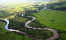
The main riverbed is divided into channels. A certain shape of the mouth is formed. It's called the delta. Its beginning is the place of separation of the Buzan branch from the bed of the Volga river. The delta is located 46 km north of the city of Astrakhan. It includes channels, branches, small rivers. There are several main branches, but only Akhtuba is navigable. Among all the rivers of Europe, the Volga is distinguished by the largest delta, which is a rich fish region in this basin.
It lies 28 m lower than the ocean level. The mouth of the Volga is the location of the southernmost Volga city of Astrakhan, which in the distant past was the capital of the Tatar Khanate. Later, at the beginning of the 18th century (1717), Peter 1 gave the city the status of "the capital of the province of Astrakhan." During his reign, the main attraction of the city, the Assumption Cathedral, was built. Its Kremlin is made of white stone, brought from the capital of the Golden Horde, the city of Saray. The mouth is divided by branches, the largest of which are: Bolda, Bakhtemir, Buzan. Astrakhan is a southern city located on 11 islands. Today it is a city of shipbuilders, sailors and fishermen.

Currently, the Volga needs protection. For this purpose, a reserve has been established at the place where the river flows into the sea. Volga Delta, largest river, flowing into the Caspian Sea, is replete with unique flora and fauna: sturgeon species of fish, lotuses, pelicans, flamingos and others. Immediately after the revolution of 1917, a law was passed on their protection by the state as part of the Astrakhan Reserve.
Sulak River
It is located in Dagestan, flows through its territory. It feeds on the waters of melted snows that flow down from the mountains, as well as tributaries: Small Sulak, Chvakhun-bak, Akh-su. Water also enters Sulak through a canal from the Aksai and Aktash rivers.
The source is formed by the confluence of two rivers that originate in the basins: Didoyskaya and Tushinskaya. The length of the Sulak River is 144 km. Its pool has a fairly large area - 15,200 square meters. It flows through the canyon with the same name as the river, then through the Akhetlinsky gorge and finally comes to the plane. Going around the Agrakhan Bay with south side, Sulak flows into the sea.

The river provides drinking water for Kaspiysk and Makhachkala, and is home to hydroelectric power stations, the urban-type settlements of Sulak and Dubki, and the small town of Kizilyurt.
Samur
The river got its name not by chance. The name translated from the Caucasian language (one of them) means "middle". Indeed, the border between the states of Russia and Azerbaijan is marked along the waterway along the Samur River.
The sources of the river are glaciers and springs, originating in the spurs of the Caucasus Range from the northeast side, not far from the Guton mountain. The height above sea level is 3200 m. Samur has a length of 213 km. The height in the upper reaches and the mouth differs by three kilometers. The catchment basin has an area of almost five thousand square meters.
The places where the river flows are narrow gorges located between the mountains. high altitude, composed of shale and sandstone, which is why the water here is muddy. The Samur basin has 65 rivers. Their length reaches 10 km or more.

Samur: the valley and its description
The valley of this river in Dagestan is the most densely populated region. Derbent is located near the mouth - ancient city peace. The banks of the Samur River are home to twenty or more species of relict representatives of the flora. Endemic, endangered and rare species listed in the Red Book grow here.
In the river delta, a relict forest is comfortably located, which is the only one in Russia. Liana forest is a fairy tale. Huge trees of the rarest and most common species grow here, intertwined with lianas. The river is rich in valuable species of fish: mullet, pike perch, pike, catfish and others.
Terek
The river got its name from the Karachay-Balkar peoples who lived along its banks. They called it "Terk Suu", which means "rushing water" in translation. Ingush and Chechens called it Lomeki - "mountain water".
The beginning of the river is the territory of Georgia, the Zigla-Khokh glacier - a mountain located on the slope of the Caucasus Range. It is under glaciers all year round. One of them melts when sliding down. A small stream is formed, which is the source of the Terek. It is located at an altitude of 2713 m above sea level. The length of the river flowing into the Caspian Sea is 600 km. At the confluence with the Caspian, the Terek is divided into many branches, as a result of which a vast delta is formed, its area is 4000 square meters. In some places it is very swampy.
The course in this place has changed several times. The old arms have now been turned into channels. The middle of the last century (1957) was marked by the construction of the Kargaly hydroelectric complex. It is used to supply water to the channels.

How is the Terek replenished?
The river has a mixed supply, but for the upper reaches, water from the melting of glaciers plays an important role, they fill the river. In this regard, 70% of the runoff occurs in spring and summer, that is, at this time the water level in the Terek is the highest, and the lowest - in February. The river freezes if the winters are characterized by a harsh climate, but the freeze-up is unstable.
The river is not distinguished by cleanliness and transparency. The turbidity of the water is large: 400-500 g/m 3 . Every year, the Terek and its tributaries pollute the Caspian Sea, pouring into it from 9 to 26 million tons of various suspensions. This is due to the rocks of which the shores are composed, and they are clayey.
Terek mouth
The Sunzha is the largest tributary flowing into the Terek, the lower reaches of which are measured precisely from this river. By this time, the Terek flows for a long time over the flat terrain, leaving the mountains located behind the Elkhot Gates. The bottom here is composed of sand and pebbles, the current slows down, and in some places stops altogether.
The mouth of the Terek River has an unusual appearance: the channel here is elevated above the valley, along appearance resembles a canal, which is fenced with an embankment of great height. The water level rises above the land level. This phenomenon is due to a natural cause. Since the Terek is a turbulent river, it brings sand and stones in large quantities from the Caucasus Range. Given that the current in the lower reaches is weak, some of them settle here and do not reach the sea. For the inhabitants of the area, sediments are both a threat and a boon. When they are washed away by water, floods of great destructive power occur, this is very bad. But in the absence of floods, the soils become fertile.
Ural River
In ancient times (until the second half of the 18th century), the river was called Yaik. It was renamed into the Russian style by the decree of Catherine II in 1775. Just at this time, the Peasant War was suppressed, the leader of which was Pugachev. The name is still preserved in the Bashkir language, and in Kazakhstan it is official. The Urals are the third longest in Europe, only the Volga and the Danube are larger than this river.

The Ural originates in Russia, on the slope of the Kruglyaya Sopka of the Uraltau Ridge. The source is a spring gushing out of the ground at an altitude of 637 m above sea level. At the beginning of its journey, the river flows in a north-south direction, but after meeting a plateau on the way, it makes a sharp turn and continues to flow in a north-westerly direction. However, beyond Orenburg, its direction again changes to the southwestern, which is considered the main one. Having overcome the winding path, the Ural flows into the Caspian Sea. The length of the river is 2428 km. The mouth is divided into branches and tends to shallow.
The Ural is a river along which the natural water boundary between Europe and Asia passes, with the exception of the upper reaches. This is an inland European river, but its upper reaches east of Ural Range are the territory of Asia.
Importance of the Caspian rivers
The rivers flowing into the Caspian Sea are of great importance. Their waters are used for human and animal consumption, domestic needs, agricultural and industrial needs. Hydroelectric power plants are being built on the rivers, the energy of which is in demand by man for various purposes. River basins are full of fish, algae, shellfish. Even in ancient times, people chose river valleys for future settlements. And now cities and towns are being built on their banks. Rivers ply passenger and transport ships, performing important tasks for the transport of passengers and goods.
, Kazakhstan, Turkmenistan, Iran , Azerbaijan
Geographical position

Caspian Sea - view from space.
The Caspian Sea is located at the junction of two parts of the Eurasian continent - Europe and Asia. The length of the Caspian Sea from north to south is approximately 1200 kilometers (36°34 "-47°13" N), from west to east - from 195 to 435 kilometers, on average 310-320 kilometers (46°-56° v. d.).
The Caspian Sea is conditionally divided according to physical and geographical conditions into 3 parts - the North Caspian, the Middle Caspian and the South Caspian. The conditional border between the North and Middle Caspian runs along the line of about. Chechnya - Cape Tyub-Karagansky, between the Middle and South Caspian - along the line of about. Residential - Cape Gan-Gulu. The area of the Northern, Middle and Southern Caspian is 25, 36, 39 percent respectively.
Coast of the Caspian Sea

Coast of the Caspian Sea in Turkmenistan
The territory adjacent to the Caspian Sea is called the Caspian Sea.
Peninsulas of the Caspian Sea
- Ashur-Ada
- Garasu
- Zyanbil
- Hara Zira
- Sengi-Mugan
- Chygyl
Bays of the Caspian Sea
- Russia (Dagestan, Kalmykia and Astrakhan region) - in the west and northwest, the length of the coastline is about 1930 kilometers
- Kazakhstan - in the north, northeast and east, the length of the coastline is about 2320 kilometers
- Turkmenistan - in the southeast, the length of the coastline is about 650 kilometers
- Iran - in the south, the length of the coastline is about 1000 kilometers
- Azerbaijan - in the southwest, the length of the coastline is about 800 kilometers
Cities on the coast of the Caspian Sea
On the Russian coast there are cities - Lagan, Makhachkala, Kaspiysk, Izberbash and the most Southern City Russian Derbent. Astrakhan is also considered a port city of the Caspian Sea, which, however, is not located on the shores of the Caspian Sea, but in the Volga Delta, 60 kilometers from the northern coast of the Caspian Sea.
Physiography
Area, depth, volume of water
The area and volume of water in the Caspian Sea varies significantly depending on fluctuations in water levels. At a water level of -26.75 m, the area is approximately 371,000 square kilometers, the volume of water is 78,648 cubic kilometers, which is approximately 44% of the world's lake water reserves. The maximum depth of the Caspian Sea is in the South Caspian depression, 1025 meters from its surface level. In terms of maximum depth, the Caspian Sea is second only to Baikal (1620 m) and Tanganyika (1435 m). The average depth of the Caspian Sea, calculated from the bathygraphic curve, is 208 meters. At the same time, the northern part of the Caspian Sea is shallow, its maximum depth does not exceed 25 meters, and the average depth is 4 meters.
Water level fluctuations
Vegetable world
The flora of the Caspian Sea and its coast is represented by 728 species. Of the plants in the Caspian Sea, algae predominate - blue-green, diatoms, red, brown, char and others, of flowering - zoster and ruppia. By origin, the flora belongs mainly to the Neogene age, however, some plants were brought into the Caspian Sea by man either consciously or on the bottoms of ships.
History of the Caspian Sea
Origin of the Caspian Sea
Anthropological and cultural history of the Caspian Sea
Finds in the Khuto cave near the southern coast of the Caspian Sea indicate that a person lived in these parts about 75 thousand years ago. The first mention of the Caspian Sea and the tribes living on its coast are found in Herodotus. Approximately in the V-II centuries. BC e. Saka tribes lived on the coast of the Caspian Sea. Later, during the period of the settlement of the Turks, in the period of the 4th-5th centuries. n. e. Talysh tribes (Talysh) lived here. According to ancient Armenian and Iranian manuscripts, the Russians sailed the Caspian Sea from the 9th-10th centuries.
Exploration of the Caspian Sea
The exploration of the Caspian Sea was started by Peter the Great, when, on his orders, an expedition was organized in 1714-1715 under the leadership of A. Bekovich-Cherkassky. In the 1720s, hydrographic studies were continued by the expedition of Karl von Werden and F.I. Soymonov, later by I.V. Tokmachev, M.I. Voinovich and other researchers. At the beginning of the 19th century, instrumental surveying of the banks was carried out by I.F. Kolodkin, in the middle of the 19th century. - instrumental geographic survey under the direction of N. A. Ivashintsev. Since 1866, for more than 50 years, expeditionary research on the hydrology and hydrobiology of the Caspian Sea has been carried out under the leadership of N. M. Knipovich. In 1897, the Astrakhan Research Station was founded. In the first decades of Soviet power in the Caspian Sea, geological research by I. M. Gubkin and other Soviet geologists was actively carried out, mainly aimed at finding oil, as well as research on the study of the water balance and fluctuations in the level of the Caspian Sea.
Economy of the Caspian Sea
Mining of oil and gas
Many oil and gas fields are being developed in the Caspian Sea. The proven oil resources in the Caspian Sea are about 10 billion tons, the total resources of oil and gas condensate are estimated at 18-20 billion tons.
Oil production in the Caspian Sea began in 1820, when the first oil well was drilled on the Absheron shelf near Baku. In the second half of the 19th century, oil production began on an industrial scale on the Absheron Peninsula, and then on other territories.
Shipping
Shipping is developed in the Caspian Sea. Ferry crossings operate on the Caspian Sea, in particular, Baku - Turkmenbashi, Baku - Aktau, Makhachkala - Aktau. The Caspian Sea has a navigable connection with the Sea of Azov through the Volga and Don rivers and the Volga-Don Canal.
Fishing and seafood
Fishing (sturgeon, bream, carp, pike perch, sprat), caviar, and seal fishing. More than 90 percent of the world's sturgeon catch is carried out in the Caspian Sea. In addition to industrial production, illegal production of sturgeon and their caviar flourishes in the Caspian Sea.
Recreational resources
The natural environment of the Caspian coast with sandy beaches, mineral waters and therapeutic mud in the coastal zone creates good conditions for rest and treatment. At the same time, in terms of the degree of development of resorts and the tourism industry, the Caspian coast noticeably loses to the Black Sea coast of the Caucasus. At the same time, in recent years, the tourism industry has been actively developing on the coast of Azerbaijan, Iran, Turkmenistan and Russian Dagestan. Azerbaijan is actively developing resort area in the Baku region. At the moment, a world-class resort has been created in Amburan, another modern tourist complex is being built near the village of Nardaran, recreation in the sanatoriums of the villages of Bilgah and Zagulba is very popular. A resort area is also being developed in Nabran, in the north of Azerbaijan. However, high prices, a generally low level of service and a lack of advertising lead to Caspian resorts almost no foreign tourists. The development of the tourism industry in Turkmenistan is hampered by a long policy of isolation, in Iran - by Sharia law, due to which the mass vacation of foreign tourists on the Caspian coast of Iran is impossible.
Ecological problems
The environmental problems of the Caspian Sea are associated with water pollution as a result of oil production and transportation on the continental shelf, the flow of pollutants from the Volga and other rivers flowing into the Caspian Sea, the vital activity of coastal cities, as well as the flooding of individual objects due to the rise in the level of the Caspian Sea. Predatory harvesting of sturgeons and their caviar, rampant poaching lead to a decrease in the number of sturgeons and forced restrictions on their production and export.
International status of the Caspian Sea
Legal status of the Caspian Sea
After the collapse of the USSR, the division of the Caspian Sea for a long time was and still remains the subject of unsettled disagreements related to the division of the resources of the Caspian shelf - oil and gas, as well as biological resources. For a long time there were negotiations between littoral states on the status of the Caspian Sea - Azerbaijan, Kazakhstan and Turkmenistan insisted on dividing the Caspian along the median line, Iran - on dividing the Caspian along one fifth between all the Caspian states.
With regard to the Caspian Sea, the key is the physical and geographical circumstance that it is a closed inland water body that does not have a natural connection with the World Ocean. Accordingly, the norms and concepts of international maritime law, in particular, the provisions of the UN Convention on the Law of the Sea of 1982, should not automatically apply to the Caspian Sea. Based on this, it would be unlawful to apply such concepts as “territorial sea”, “exclusive economic zone”, “continental shelf”, etc.
The current legal regime of the Caspian Sea was established by the Soviet-Iranian treaties of 1921 and 1940. These treaties provide for freedom of navigation throughout the sea, freedom of fishing, with the exception of ten-mile national fishing zones, and a ban on navigation in its waters of ships flying the flag of non-Caspian states.
Negotiations on the legal status of the Caspian are currently ongoing.
Delimitation of sections of the bottom of the Caspian Sea for the purpose of subsoil use
The Russian Federation concluded an agreement with Kazakhstan on the delimitation of the bottom of the northern part of the Caspian Sea in order to exercise sovereign rights to subsoil use (dated July 6, 1998 and the Protocol dated May 13, 2002), an agreement with Azerbaijan on the delimitation of adjacent sections of the bottom of the northern part of the Caspian Sea (dated September 23, 2002), as well as the trilateral Russian-Azerbaijani-Kazakhstan agreement on the junction of the demarcation lines of adjacent sections of the Caspian Sea bottom (dated May 14, 2003), which established geographical coordinates dividing lines delimiting seabed areas within which the parties exercise their sovereign rights in the field of exploration and production of mineral resources.
The Caspian Sea is simultaneously considered as drainless lake, and a full-fledged sea. The reasons for this confusion are brackish waters and a marine-like hydrological regime.
The Caspian Sea is located on the border of Asia and Europe. Its area is about 370 thousand km 2, the maximum depth is just over one kilometer. The Caspian has a conditional division into three almost equal parts: Southern (39% of the area), Middle (36%) and Northern (25%).
The sea washes simultaneously Russian, Kazakh, Azerbaijani, Turkmen and Iranian shores.
Coast of the Caspian Sea(Caspian) has a length of about 7 thousand kilometers, if you count together with the islands. In the north, the low sea coast is covered with swamps and thickets, and has multiple water channels. Eastern and West Coast The Caspian has a sinuous shape, in some places the coast is covered with limestone.
There are many islands in the Caspian Sea: Dash-Zira, Kyur Dashi, Dzhambaisky, Boyuk-Zira, Gum, Chigil, Khere-Zira, Zenbil, Ogurchinsky, Tyuleniy, Ashur-Ada, etc. Peninsulas: Mangyshlak, Tyub-Karagan, Absheron and Miankale. Their total area equals approximately 400 km 2.
flows into the Caspian Sea more than a hundred different rivers, the most significant are the Ural, Terek, Volga, Atrek, Emba, Samur. Almost all of them provide the sea with 85-95% of the annual runoff.
The largest bays of the Caspian Sea: Kaydak, Agrakhansky, Kazakh, Dead Kultuk, Turkmenbashi, Mangyshlak, Gyzlar, Girkan, Kaydak.

Climate of the Caspian
The Caspian is located in three climatic zones at once: subtropical climate in the south, continental in the north and temperate in the middle part. In winter, the average temperature varies from -10 to +10 degrees, while in summer the air warms up to about +25 degrees. During the year falls from 110 mm of precipitation in the east and up to 1500 mm in the west.
The average wind speed is 3–7 m/s, but in autumn and winter it often increases to 35 m/s. The most blown areas are the coastal regions of Makhachkala, Derbent and the Absheron Peninsula.
Water temperature in the Caspian Sea fluctuates from zero to +10 degrees in winter, and from 23 to 28 degrees in summer months. In some coastal shallow waters, the water can warm up to 35‒40 degrees.
Only the northern part of the sea is subject to freezing, but in especially cold winters, the coastal zones of the Middle Part are added to it. Ice cover appears in November and disappears only in March.

Problems of the Caspian region
Water pollution is one of the main environmental problems of the Caspian. Oil production, various harmful substances from flowing rivers, waste products from nearby cities - all this adversely affects the state of sea water. Additional troubles are created by poachers, whose actions reduce the number of fish of certain species found in the Caspian Sea.
Sea level rise also causes serious financial damage to all the Caspian countries.
According to conservative estimates, the restoration of destroyed buildings and the implementation of comprehensive measures to protect the coast from flooding costs tens of millions of dollars.

Cities and resorts on the Caspian Sea
The largest city and port washed by the waters of the Caspian Sea is Baku. Among the others settlements Azerbaijan, located in close proximity to the sea, are Sumgayit and Lankaran. On the eastern shores is the city of Turkmenbashi, and about ten kilometers from it by the sea is the large Turkmen resort of Avaza.
On the Russian side, the following cities are located on the seashore: Makhachkala, Izberbash, Derbent, Lagan and Kaspiysk. Astrakhan is also often referred to as a port city, although it is located about 65 kilometers from the northern shores of the Caspian Sea.

Astrakhan
Beach holidays in this region are not provided: along the sea coast there are only continuous reed thickets. However, tourists go to Astrakhan not for idle lying on the beach, but for fishing and various types active rest: diving, catamaran, jet skiing, etc. In July and August, excursion boats ply the Caspian.

Dagestan
For a classic seaside vacation, it is better to go to Makhachkala, Kaspiysk or Izberbash - this is where not only good sandy beaches but also decent recreation facilities. The range of entertainment on the seashore from the Dagestan side is quite wide: swimming, therapeutic mud springs, windsurfing, kiting, rock climbing and paragliding.
The only disadvantage of this direction is the underdeveloped infrastructure.
In addition, among some Russian tourists There is an opinion that Dagestan is far from the most peaceful territory that is part of the North Caucasian Federal District.

Kazakhstan
Much more relaxed atmosphere can be found in the Kazakh resorts of Kuryk, Atyrau and Aktau. The last one is the most popular tourist city Kazakhstan: there are many good entertainment venues and well-maintained beaches. In summer, the temperature here is very high, reaching +40 degrees during the daytime, and dropping only to +30 at night.
Disadvantages of Kazakhstan tourist country- the same poor infrastructure and rudimentary transport links between regions.

Azerbaijan
by the most the best places Baku, Nabran, Lankaran and other Azerbaijani resorts are considered for recreation on the Caspian coast. Fortunately, everything is fine with the infrastructure in this country: for example, several modern comfortable hotels with swimming pools and beaches have been built in the area of the Absheron Peninsula.
However, in order to enjoy relaxing on the Caspian Sea in Azerbaijan, you need to spend a lot of money. In addition, you can get to Baku quickly enough only by plane - trains run rarely, and the journey from Russia itself takes two to three days.
Tourists should not forget that Dagestan and Azerbaijan are Islamic countries, so all "infidels" need to adjust their habitual behavior to local customs.
If you follow the simple rules of your stay, nothing will overshadow your vacation on the Caspian Sea.