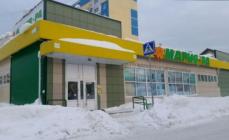
The Aksaut camp site is located on the territory of the Karachay-Cherkess Republic, 2 kilometers from the village of Krasny Karachay. Surrounded picturesque mountains, the river Aksaut flows nearby. There are trout in the river. At a distance of about three kilometers from the base, with local residents, you can arrange a trip through the surrounding mountains on horseback. There are many beautiful places in the vicinity: barberry meadow, waterfalls, passes. There are many raspberries, strawberries and mushrooms in the area. Currently, the base has a canteen building, a bathhouse, two and five - local houses. The houses have stoves, potbelly stoves, mattresses, pillows and blankets. Extra bed linen is available. Lights are turned on for several hours in the evening. A gas oven, crockery and fire pits are at your service.
DOCUMENT REGISTRATION: To rest at the Aksout Camp site, you must conclude an agreement and receive an order for resettlement in the MBU DOEC "Grenada", which you provide to the caretaker for resettlement. The cost of living - 200 rubles per day, students educational institutions Nevinnomyssk -150 rubles per day, children under 5 years old - free of charge. Since the base is located in the border zone, it is necessary to take care of issuing the appropriate passes at the KChR Border Guard. If you plan to exit difficult routes it is necessary to pass a notification registration with the Ministry of Emergency Situations of the KChR. The list of the group indicates: full name, place of work (study), address, series and number of the passport, where, when and by whom it was issued.
TRAVEL: Since there are twenty kilometers of a very bad road in front of the base, the trip must be carried out on cars such as "Niva", "Uaz" or buses of the type "Kavz", "Paz". The total distance from the city of Nevinnomyssk to the base is 160 km.
From Nevinnomyssk we go towards the city of Cherkessk, having passed two traffic police posts, after the descent, before the village of Adil-Khalk, turn right. We drive along the main road to the village of Psauche-Dakhe, where we turn left onto Khabez. After crossing the river there will be a roundabout - turn right. Having passed Khabez, we continue moving in the direction of the village of Kardonikskaya. In the village of Kardonikskaya, in the market area, turn right to the forestry. The village of Kardonikskaya is the last point where you can buy something in the store. From Kardonikskaya, the road goes to the village of Khasaut-Grechesky and through it to the Aksautsky forestry. After the forestry, after 7 kilometers you drive past the tourist town of Kishket, then a winding road along the bank of the Aksaut River will lead to the almost abandoned village of Krasny Karachay. After crossing the bridge there will be a fork in the road, you must turn left and go down the hill again to the left. After passing through the clearing, you will see the houses of the Aksaut camp site. Practice shows that to the village of Khasaut Greek travel is 2 hours (115 km on asphalt) and from Khasaut Greek to the base, depending on the class and passability of the car, from 1.5 to 2.5 hours (45 km off-road).
EQUIPMENT: the mountains have their own microclimate, so in the mornings there is very heavy dew and it can suddenly rain. Be sure to take a raincoat and waterproof shoes (rubber boots or mountain boots) with you, stock of socks, including warm ones, spare shoes. It is cold in the evenings, so warm clothes (sweater, jacket, hat) are needed. For sleep, warm pajamas (or something similar) are desirable; a warm blanket and bedding are required. In case you want to take a walk in the surrounding mountains, take care of the appropriate footwear.
NUTRITION: food can be cooked on a fire (in specially equipped places) or on a gas stove. Water for drinking and cooking can be collected in the mountain spring near the base. Firewood can be collected near the base. Have pots or pans, plates, a cup, a spoon, a knife with you. Do not forget matches and old newspapers for ease of kindling a fire. Take food based on preferences and number of meals.

Travel area map.
AKSOUT
In the Aksaut valley there is a small village of Krasny Karachay livestock breeders and a half-abandoned village. Aksaut founded by geologists ( locals more know it under the name Rudnichny), dairy farms operate in the summer. There are many tourists in the gorge. Along the rivers Kichi-Teberda and Ullu-Marka, the right tributaries of the Aksaut, you can go to the passes to Teberda and Dombai. There are trails to the hanging valleys of the left slope, where the shepherds stand. From there there are easy, albeit high, passes to the Marukh valley.
Aksaut originates from the large GKH glaciers in the area where average height exceeds 3500 m. Glaciers, including one of the longest in the West. Caucasus l. Jalau Chat are quite accessible and can be visited by novice tourists with an experienced leader. Climbing the snow-ice passes and peaks of the GKH is attractive for sports groups.
The river breaks out of the mountains near the station. Kardonikskaya, through which the highway from Cherkessk to Zelenchukskaya passes. The turn to the road up the Aksaut is located near the Kardonikskaya bus station. A bus runs along this road several times a day from the station. Zelenchukskaya in the village. Hasaut-Greek (less than 20 km). Then you need to get on passing cars about 25 km to the village of shepherds Krasny Karachay, which serves as a starting point for routes along Aksaut. Opposite with. Khasaut-Grechesky you can see the portal of the tunnel, the construction of which began in the Soviet years. It was intended to transfer water from Zelenchuk to the Kuban. The spurs of the Front Range approach the village.
Aksaut flows out of a wooded gorge onto spacious pebbles. The road to the village Red Karachay is laid along the bottom of a deep gorge and pressed against the river by steep slopes covered with dense deciduous forest. Occasionally, the valley widens slightly, giving way to clearings where foresters have set benches for rest. A few kilometers from the Khasaug-Greek, at the "Wet Glade", through the bridge on the left side the road branches off to the pastures of Yesen. Gradually, the forest thins out, becoming mixed (there are also artificial pine plantations), and above you can see meadows, monotonous scree strips, rock ridges. At 9 km in the tract Kyshkyt rest camp.
The valleys that cross the Front Range are evidence that its uplift began no earlier than the uplift of the Main Range. The rate at which the flow originated on the main watershed bites into the underlying rocks increases with the general uplift of the system (because the slope increases) and turns out to be faster than the average erosion of the massifs of the Front Range. As a result, deep (and in morphologically young near-bottom parts - steep-walled) gorges and canyons in hard rocks are developed. The longitudinal profile of the valley also changes with time: steep, intensely cutting drops slowly move upwards. The strength of the river was always enough to saw through the gap faster than the raising of the ridge, so that dams did not form.
Even in dry weather, Aksaut has muddy water. During the rains, the river erodes the banks, islands, carries trees, layers of turf. The sound of moving stones is heard. The material for this conveyor, which distributes sediments, is supplied by alluvial fans of numerous tributaries. Several times the road with short ascents and descents briefly moves away from the river. The last kilometers in front of Krasny Karachay, it goes through an open valley, in the middle of which farms, sheds, sheds are scattered. The village is located at an altitude of 1500m, 4th at the confluence of the Aksaut river. Ullu Mark. There is a cheese factory, farms are scattered in the vicinity, which are driven around daily by a milk truck. There is no post office, the nearest one is in the village. Hasaut-Greek.
M4. The village of Krasny Karachay - pos. Aksout - l. Aksaut (29 km, road, trail).
From the village Red Karachay up the left bank of Aksaut there is a road to the former settlement of geologists. Behind the village there is a branch of MBU DOEC "Grenada" Turbaza "Aksaut" in summer time organized on the basis camping for schoolchildren of the city of Nevinnomyssk The wide floodplain of the river is occupied by meadows, groves, the sides of the gorge are covered with forests. Along the road stretches a chain of dairy farms. It is cool in the valley, it is blown by winds from glaciers.
Eight kilometers from the village. Red Karachay with a spacious, raspberry-colored glade from blooming thistles with groups of pines and birches, for the first time, the jagged rocky ridge of the Kara-Kaya mountain (3893 m) is visible. From the farm behind the clearing begins the ascent (through the burnt-out) to the lane. Kyzyl-Aush to the Marukh valley. We soon pass a stone gate between low walls with loopholes. On the cast plate the inscription: " Memorial Complex. Defense trail»
This is the first of the monuments erected in the mid-80s. on the way through the Marukh Pass, where heavy fighting took place in 1942
The last farm is 0.5 km from the monument. On the slope above it, in a strip of bushes, a trace of a powerful avalanche is visible. At a time when the road to Rudnichny operated year-round, avalanches threatening it were shot down from cannons.
We pass through the river. Khadyuk, flowing from a wooded gorge, along which there is a path to the pass of the same name on Marukh. From the clearing near the bridge, the Aksauta rocky massif (3910 m) with glaciers, closing the Aksaut valley, was opened, and to the left of it - the dark pyramid Mal. Aksaut.
At 12 km from the village, the road passes over the bridge to the right bank of the Aksaut and rises to an uneven clearing bordered by birches, aspens, spreading beeches. There are rare pine trees near the river. From here you can see the peaks of Aksaut and Kara-Kaya. Then we go to the mixed forest, where there are a lot of strawberries and mushrooms. After 8-9 km from the bridge, the driveway leads to the village, located among the pines at an altitude of about 1900 m and 0.5 km from the confluence with the Aksaut river. Kichi-Teberda. In the massif of the city of Kichi-Teberda, towering above the entrance to this valley, tungsten ore was mined for about 30 years. Now several houses of Rudnichny are occupied by border guards and rescuers.
Along the river Kichi-Teberda lies the path to the lane. Khuty to Teberda and to the passes of the 73rd and Kichi-Teberda to Dombay. A little higher than the village, a throne descends to Aksaut from the lane. S. Kara-Kaya from the Marukh gorge.
Beyond the village, the road forks. One turns into the valley of Kichi-Teberdy, from where it climbs to the adits on the slope of the mountain of the same name. Another, less fortified initially and now rapidly collapsing, crosses the river. Kichi-Teberda, above which, in the forest, a waterfall rumbles, and continues on a rocky floodplain in the direction of the right slope visible in front of a wooded cape.
At the riverbed, stone ridges piled up by bulldozers are noticeable in order to prevent the branches of the river from reaching the buildings and the road. Pine trees have strengthened on the protected part of the floodplain. However, the left-bank forest is dying, which has become more often flooded with floods carrying stones. On a sultry July day, the air above the hot pebbles is infused with carnations. But the snows of the Main Range are close. Ahead, in the green alignment, a heap of icy rocks of Aksaut has grown, to the left rises the dark tip of Mal. Aksauta and the pockmarked snow-covered wall
Jalau-Chat (3884 m). The Aksautsky glacier is already visible.
There is a mighty fir forest on the cape. In the shade of old trees, hung with lichens, it is always damp, puddles darken on the stones. A road was made in the forest to the adit, the dump of which was visible 100 m above the floodplain. Trunks and roots of firs near the road are damaged. Meanwhile, all sorts of wounds, even due to breaking off branches, cause rot damage in Caucasian fir, as a non-resin-producing breed. A forest with a large proportion of injured trees is doomed.
Behind the cape Aksaut receives the turbulent flow of Jalau-Chat. Just below the confluence, a thick log is thrown across the river. On the hillock of the left bank overgrown with pines, there are traces of old lodgings. A few hundred meters up the river. Jalau-Chat, where it breaks out of the canyon, hangs a bridge with a railing. In front of this bridge, the path to the lane goes up, into the fir forest. Alibek.
About 4 km (2-3 hours of walking) remains to the Aksaut glacier. There are trails on both banks of the Aksaut, at the end of summer the right bank is more reliable, because there may not be a snow bridge across the stream that flows into the Aksaut on the left just before the Aksaut glacier.
Behind the crossing through Dzhalau-Chat the forest becomes smaller - the proximity to the glacier affects. A little higher, Aksaut is squeezed by a gorge, and the coast becomes impassable due to thickets of birch. It is better to overcome them further from the river. At the exit from the bush, the foresters set up a pillar - this is the southern border of the forest in the Aksauta gorge. It is still about 2 km to the glacier on the rocks along the river. In the south, its icefall is clearly visible, hiding the crest of the lane behind it. Aksout. The tongue of the glacier is strewn with stones, but the very end (about 2200 m) is clear - a smooth ice slope. From time to time, stones slide off the slope - this is how the final moraine is deposited. On the flat right moraine overgrown with willow, you can camp.
In front of the tongue of the Aksaut glacier, a stream flows into Aksaut from the west from a narrow gorge between the massifs of Kara-Kaya (to the observer's right) and Bratsy. Zap. Aksaut, to which about 2 km. Previously, this glacier connected with the Aksautsky glacier, as evidenced by the high ridge of the lateral moraine left on the left bank of the stream. K Zap. We make our way along the right bank of the Aksaut glacier. After 1.5 hours of a noticeable ascent, we reach a steep tongue (2400 m). Having climbed the glacier, we walk along it for about an hour before turning to the south, behind which a wide snow lane opens. Zap. Aksaut (it leads to the Karach River - the left tributary of the Yu. Marukh).
Around the lifeless rocks of the peaks of Kara-Kaya, Bratsy, Marukh-Bashi. The noise of the river does not reach here, the silence is broken only by the roar of ice landslides from Marukh-Kaya. To see the mountains awaken from their icy stupor, it is worth spending the night here. There are sites on the left moraine under the river. Yu. Karakaysky, falling from the saddle between Kara-Kaya and Marukh-Bashi.
M5. River valley Aksout - l. Jalau-Chat (trail, 1 day).
The Jalau-Chat River originates from one of the largest glaciers in the West. Caucasus, to which you can climb, using the path laid around the canyon leading to the lane. Alibek.
You can get on the trail by turning into the forest from the last knee of the road from the cape to the adit (M4), at the gas tank. The overgrown path rises above the canyon in a fir forest, then in a mixed forest. Only having gained several hundred meters of height and having entered the zone of crooked forests, it approaches the edge of the gorge for a short time. You can see the beginning of the canyon, the walls of which are smoothed into "ram's foreheads", and the snowy fields of the glacier. The trail continues climbing through the beech forest, birch bushes, mountain ash, rhododendron. It is very steep in places - a dirty chute straight up. This is a feature of hiking trails, pastoral trails are lighter, with zigzags.
Finally, we get to the meadow shoulder above the cliff, where you can rest. A path branches off to the left, traversing the slope of Kichi-Teberda near the bush border and leading to the mine adits. It would be possible from the village. Aksaut climb to the adits along the road and go to the canyon along this path (this is how they do it more often now). Now the tongue of the glacier is clearly visible (it seems that we are already almost on the same level with it) and the upper cirque, torn by cracks, above which the snow-capped peak of Jalau-Chat has grown. It remains a little to the place where you can turn to the glacier.
The trail climbs a gentle meadow with a stream and a paddock (sheep graze) in a hollow between the long grassy slope of Kichi-Teberda and the short rocky scree of Sulakhat (3409 m), which is now visible in the east. To the north of this peak, in front of the hollow, one can see the snowy saddle of the lane. Sulakhat, leading to the valley of the river. Alibek, in Dombay. Still further north is another pass in Dombai - Alibeksky, now hidden by the slope of the city of Kichi-Teberda. Its saddle with a characteristic rock-"horn" can be seen by climbing the mentioned spur of Sulakhat. The Alibek pass is very popular, and in the hollow where we climbed (2400 m), people often stop to rest or spend the night. This place is called "Green Hotel".
to l. Jalau Chat (now we are at his level) remains 1.5-2 km. To get there, you need to go around the spur of the city of Sulakhat. A simple, with a slight decrease, the path along the old, overgrown with grass and small bushes "ram's foreheads" leads to a flat sandy field in front of the tongue of the glacier (2310 m). If you go higher, with the intersection of unstable talus (several hundred meters), you immediately get to the glacier. IN downstream its surface is flat, and it is easy to advance to the middle of the glacial cirque.
With each step, the panorama of the surrounding peaks unfolds wider. Above the belt of "ram's foreheads" and the hanging glaciers of the left slope (for the observer on the right), the sheer walls of the Aksaut massif rise. In the south, behind the icefall, the snow-rocky hump of the Dzhalau-Chat mountain grows. Marked by rare gendarmes - "teeth" depression in the snowy ridge next to it - lane. Fog.
The broken crest of the buttress holding the icefall at the starboard side leads to the Sunakhet summit. To the north of this peak, above the strip of “ram's foreheads”, there is a gentle glacier of the same name (there are bivouacs in front of it). On the glacier it is easy to climb the lane. Dzhalau-Chat (in Dombay). Opposite, in the northern ridge of Aksaut, the saddle of the lane is visible. Lower Aksaut (3000 m, 1 A), leading to the l. Aksaut, and a snow-scree couloir under it. On one of the median moraines or on the aforementioned sites on top of the "foreheads" (in front of the Sunakhet lava), you can get a lodging for the night. Return along the path of ascent.
MARUCH. AKSOUT
The most mountainous region of the Western Caucasus, stretching to Elbrus, begins with a section of the Main Range, which is adjacent to the gorges of Marukh, Aksaut and Chkhalta. On this 20-kilometer stretch, three peaks have a height of more than 3800 m. north side carries significant glaciation (on Marukh about 3.5 sq. km, on Aksaut - more than 17 sq. km), including large valley glaciers. On a steep, breaking off at 2 km to the river. Chkhalta on the southern slope of the glaciers (except for the Yu. Marukhsky) are cirque, hanging.
Of the ranges extending to the north, the highest is Teberdinsky (up to 3758 m). It separates the Aksaut valley from the Teberda basin. The ridge is strongly dissected, in the axial part it has young alpine forms and many glaciers. The Mysty-Bashi ridge separating the Aksaut and Marukh gorges is calmer and almost without glaciation. Partially smoothed out, acquiring mature morphological forms and the watershed of Marukh and Zelenchuk - Mt. Uzhum.
Cool, thanks to the winds blowing through the Marukh pass and from the vast glaciers, the Marukh and Aksaut valleys are overgrown with coniferous, mostly pine, and mixed forests. True, these forests have suffered greatly from intensive grazing and logging. Humid warm gorge of Chkhalty is completely covered with fir and beech forests. The southern hard-to-reach slope of the GKH in places retains its originality; shepherding here, as in the distant past, affects only small islands.
Roads are laid along the gorges, but on Marukh there are villages only below. On Aksaut, the last settlement (now practically abandoned) is located in the upper reaches. Extended sections of the Marukh and Aksaut valleys are occupied by livestock farms.
Through the GKH in this area there is only one low, and simple lane. Marukh, now closed for tourists. The rest - snow-ice - may be of interest for one-sided ascents of sports groups. The meridional ridges are accessible in many places, and there are trails to a number of passes.
MARUKH GORGE
The Marukh Gorge, 60 km long, leads to one of the simplest, known in antiquity, passes through the GKH - per. Marukh. In the Middle Ages, the "Silk Road" from Sogd (Central Asia) to Byzantium ran through it. And later this path remained one of the most important communications in the mountains, although in some periods the conditions on the pass turned out to be harsh. So, in the middle of the XIX century. two battalions of Russian troops, heading from the Kuban line to Sukhum, met a lot of snow on Marukh in early August. It is known, however, that in 1877, during the Russian-Turkish war, a detachment of General P. D. Babich passed through this pass. In the autumn of 1942, through Marukh, as well as through other relatively accessible passes, the Nazis tried to break through into Transcaucasia; the front stopped on its southern slope.
Passage lane. Marukh can be done by a group of beginners under the guidance of an experienced instructor. In the post-war decades, hundreds of tourist groups crossed it every year (mostly from north to south, to Abkhazia). Now we will limit ourselves to describing the path only to the foot of the pass. We note one feature: the route for a considerable distance passes along a ridge with a height of about 2000 m (the watershed of Marukh and Zelenchuk), thanks to which the traveler opens up distant panoramas of the foothills, which, perhaps, are in the West. The Caucasus is not found anywhere else. True, the price for this is a large physical load already on the first day of walking.
M1. The village of Maruha - Mt. Uzhum - Marukh gorge - l. Marukh (55 km, road, trail, 4-5 days).
Starting point - Marukh, located at an altitude of about 1000 m on the left bank of the river. Marukh is 10-12 km from the highway that passes through the villages of Kardonikskaya and Zelenchukskaya. On the way from Cherkessk, before reaching 3 km to the station. Zelenchukskaya, the turn to the village is clearly visible along the long row of poplars; There is a local bus from the village. There is a frontier post in Marukh. Border guard posts control the entire gorge.
The southern edge of the village rests on the end of the watershed ridge. Uzhum, which separates Marukh from the neighboring Zelenchuk valley. The road to the mountains (a continuation of the one that runs along the village) rises to the watershed, bypasses the gorge in the middle reaches of the river and after 25 km descends into the valley to the farms near the pastures.
The further way to the pass (about 30 km) goes through the valley along the road and trail. At the very end of the gorge, in front of the pass, lies the Marukh glacier. The approach to the glacier will take 3-4 days, of which one, but rather two, movement along the ridge. Uzhum and descent to the valley (climb about 1100 m, descent to 650 m). Excursion to the glacier - another day. From the upper reaches of the Marukh, it is also possible to reach the Zelenchuk (Arkhyz) and Aksaut valleys.
The ascent to the ridge. Uzhum begins right behind the village along a slate slope in a sparse forest. Pears, cherries, wild rose bushes grow along the road, and in spring white caps of bird cherry are everywhere. At 150 m above Marukha, a wide hilly plain opens up to the eye, gradually descending to the west, where among the wooded ridges one can see the valley of the Vodyany stream. Near the road there are fields and cultivated meadows, the sections of which are separated by trees overgrown with stones and uprooted stumps.
There is a farm 4 km from the village, to the left of the road. From here you can see the next section of the ascent to the ridge. The reference point indicating the height to be climbed is a grassy peak above the forest, which is about 6 km away along the serpentines of the road with a climb of almost 700 m.
The road goes through a shady beech forest, only once crossing pine plantations. At the upper border of the forest there is a narrow birch belt. As you ascend, a wonderful panorama opens up. Far to the north, the cliffs of the Rocky Range show through the mist. Below you can see the wide spreading st. Zelenchukskaya, and closer stands out the stadium-like oval of the RATAN-600 radio telescope of the Special Astrophysical Observatory (SAO) of the Russian Academy of Sciences.
The winding, imperceptibly rising ridge to the south, on which the road climbs, has insignificant gentle tops, some of them have triangulation marks. The track goes around these peaks either from the west or from the east, while alternately opening pictures of the Zelenchuk and Marukh gorges. Both slopes are dissected by numerous steep ravines, which originate 100-300 m from the crest. Below, they are densely overgrown with shrubs and forests. In some places, pines, hiding from the wind behind the slopes, approach the road itself.
On a wide strip of meadows, koshi are placed, veins of paths connecting them are visible, which are laid at the edge of the forest. To some cats there are branches of the road. If the group decides to spend the night on the ridge, they should descend to the level of the cats. Near them you can find (although not at all times of the year) a stream or a spring. There is no water near the road, it goes between the inclined layers of shale. For hr. Uzhum and the Marukh valleys are characterized by strong winds, so that the koshi are often destroyed.
The panorama of the mountains changes with every kilometer. Behind the deep gorge of Marukh, the ridge rich in pastures grows higher and higher. Capes-Bashi, the peaks of the Teberdinsky ridge are visible further. Above the Zelenchuk valley filled with forests, peaks of the Mt. Abishira-Akhuba. The northern peak of the Kara-bek rocky massif is approaching ahead (with snow in May). The road will turn off the ridge, only a little before reaching it.
From the next turn to the SWZ, a silvery dome suddenly appears. This is the building of the optical telescope-reflector BTA (Large Azimuth Telescope) SAO, one of the largest in the world (mirror diameter 6 m). The observatory is located at an altitude of 2070 m on the meadow shoulder of the town of Pastukhovaya, belonging to the ridge. Uzhum. Although the distance is about 8 km, pavilions of smaller instruments are also visible - the air is so transparent here. Far below, at the bottom of the Zelenchuk Gorge, the movement of cars on the highway is discernible.
The road splits 19 km from the village. The main, well-trodden, turns sharply to the left and descends into the Marukh gorge. The other goes along the ridge, on which the remains of houses are visible about 1 km away. There in the 60s. an observatory operated, where, in particular, the state of the atmosphere was studied in connection with the construction of a large telescope. In April - early May, there may still be snow patches on the way to these ruined buildings.
Behind the ruins, the road continues for about 2 km along the ridge (until a drop in front of the town of Maly Karabek, where the kosh stands; from here one path runs down to the Marukh valley, the other traverses the mountain from the east), then turns right and, rounding the beginning of a deep gorge, descends to the observatory (about 7 km from the fork in the road). There begins a highway descending into the Zelenchuk valley, in the village. Bukovo near Nizhny Arkhyz. On the highway to the village 17 km (altitude drop is about 900 m), there is also a trail that cuts serpentines.
Let's go back to the main road. She dives between rocks overgrown with pines, into a meadow tract with a stream, at the source of which (to the left of the road) a kosh is visible. On the lower edge of a gently sloping meadow, near the edge of the forest, there is a comfortable place to rest. Further, the steepness increases, the road winds like a serpentine in a mixed forest and, finally, runs out onto the bank of the Marukh (5 km from the fork on the ridge).
Upstream, a treeless basin several kilometers long is visible, closed by the slope of the Karabek massif. Several farms are scattered along the river, and the road goes there. Cattle graze in the Maruha Valley, a cheese factory operates from May to September, and milk trucks run. The rest of the time there are no people in the gorge. The reason is the danger of avalanches, the signs of which can be traced throughout the valley.
When descending on the opposite slope, a narrow treeless terrace was visible, where, like a funnel, extended couloirs descend. Snow accumulating there can be thrown into the valley, as evidenced by a wide strip of crooked forest; pines survived only on the protruding rocks. A noteworthy detail: in the middle of the terrace there is a corral for cattle, so that to an inexperienced person the place will seem safe, inhabited. In fact, it is such only in the summer, before the autumn snowfalls.
Behind the last farm in the basin, the road passes over the bridge to the right bank. In front of the farm, it carries large stones from the slope to the river, and behind it ends a long couloir that cuts Karabek from the ridge to the foot. The buildings are protected from avalanches by cliffs overgrown with old pine forests. On the hill behind the bridge there is an obelisk to the Soviet soldiers who died in battles with the Germans on August 28 - September 2, 1942. The path goes through pine, birch, and beech groves. Large heaps of stones, overgrown with shrubs and trees, attract attention. Locals believe that these are traces of an ancient village.
The road crosses a wide alluvial fan, a damp alder forest and after 4 km from the bridge leads to a separate farm. Almost reaching it, on the left bank, where the bridge was thrown, in the buttress of the Karabek town approaching the river, 150 m above the water, 2 niches are visible. These are adits where copper ore was mined in the early Middle Ages. It is not difficult to climb there along a wide grassy ledge (a remnant of an ancient road). In front of the entrance to a deeper northern branch about 10 m long, there is a multi-ton block, the result of a collapse. By the light of a lantern, traces of a chile in greenish rock can be distinguished on a rounded vault (the rocks surrounding the cave owe their red color to lichen).
1 km above the farm, the valley is blocked by a ridge of scapes, overgrown with forest. A waterfall roars in a short gorge. In front of it, under the pines on a flat bank, there is a comfortable, cool place to rest, where shepherds often stop. To get around the ridge, the road takes you to a slope where there are houses with red tiled roofs - a cheese factory.
Above the waterfall, the character of the gorge changes: the slopes part, rare groves stretch along the river. Immediately behind the rocky ridge, the bottom of the valley is flat, swampy (once there was a lake in this place). The road is pressed against the side and only after 1.5 km does it return to the river, to the next bridge. Here you can see the path, which, climbing the left slope through a rare pine forest, goes to the lane. Ozerny in Arkhyz.
On the right bank, where there are many convenient places for a halt, a trail to the lane begins just above the bridge. Kyzyl-Aush in the Aksauta gorge; she climbs up a forested cone of sediment. The upper circus of the pass with the rocky peak of Kyzyl-Aush-Duppur (3426 m) is clearly visible from the open left bank, where the road passes. At 2 km from the bridge, she passes a farm, then another, crosses a scattering of large stones, climbs a slope and enters the forest.
The valley narrows again. The steep slopes are covered with forest and have many avalanche bands. At the beginning of summer, some corridors are still clogged with snow. For 2 km, the road crosses several such paths. It can be seen that avalanches do not always adhere to the crooked forests, where they are frequent. Snow masses break both tall aspen and birch forests, and the maturity of such a forest indicates only a relative rarity, the concealment of especially large avalanches. The latter even catch the edges of "prosperous" old pine forests.
The road zigzags down to another bridge thrown over the gap. Marukh, squeezed to a few meters, beats at a depth of 15 m. Further along the valley for 0.5 km is strewn with boulders, among which bent birch trees grow. In May, there is snow brought from the left slope. For areas that are freed from snow late, a delay in the development of the herbage and changes in its species composition are characteristic. Such deviations are noticeable in color photographs of valleys taken in midsummer, on which one of the methods for determining avalanche areas is based.
A kilometer from the gorge is another, last, bridge. A bivouac is possible on the terrace in front of it. Up the river a heap of stones and trunks; mudflow originates in the couloir of the starboard side. The road takes you into a rare pine forest on the left slope. After a couple of kilometers the forest parted, the road ends at the last farm.
The upper reaches of the gorge opened up to the lane. Marukh. Ahead for 6 km stretches a flat swampy valley, in the middle of which a river winds. Further, above the dark ledge, you can see the mounds of "ram's foreheads", a wide saddle of the pass and behind it the sharp rocky peak of Marukh-Bashi (3805 m). To the glacier at the foot of the pass remains 12 km (the path along the valley was the same) with a climb of 500 m in height.
In a swampy area, the path nestles against a forested right slope, the bridge to which is located on the edge of a gentle meadow near the farm. Halfway across the plain, by the path, stands a shepherd's stone house, and at the end of it, in a birch grove, there are dry places for a halt. A small lake remained under the left side. Kara-Kol, its excavation is beaten out by avalanches, the paths of which are marked with a birch forest.
The rocky ledge closing the plain, covered with pines, is cut by a deep 40-meter canyon "Bear's mouth", in which, hitting a niche under the left cheek, a waterfall roars. The right-bank path climbs a ledge in the forest next to the gorge.
On top of the gorge, the near slopes form a shallow basin; a snow gauge is installed in the middle of the meadow in the bend of the river. Then there are gently sloping terraces (in the spring under snow), leading to the tier of old "ram's foreheads" left by the retreating glacier. There are no trees at the bottom of the trough-valley, and bushes and pines stretch for a long time along the right slope. To the upper terrace (but in essence, these are gentle “foreheads”), the Tegey-Chat stream falls from this slope from the car under the lane. Khalega (from the Aksauta gorge, M8).
From the left slope, a scallop protrudes into the terrace, along which you can climb to the lane. Bugoy-Chat leading to Kizgych. The main path climbs the "foreheads" (the stream cut a deep channel into them), colored with spots of rhododendron, juniper and in some places covered with snow even in summer. Near the snow, tundra plants turn green - lingonberries and haddock. The ascent leads to the right moraine next to the slope. Opposite, across the river, under the rocks of the pass saddle, on the knoll of “ram's foreheads” closest to the glacier, you can see a spacious area (about 2500 m), where the glaciologists' house stood for many years.
As measurements have shown, a 2-3-meter layer accumulates on the surface of the glacier per year, in terms of water, approximately the same losses due to melting and evaporation. The balance, which fluctuates greatly in different years, is negative on average, and the glacier is currently decreasing; its tongue is receding at a rate of about 15 m per year. The intensity of melting would be higher if there were no summer snowfalls, which, increasing the reflection of solar radiation, reduce it by 1.5-2 times.
This glacier is characterized by the accumulation of blizzard snow brought from the southern slopes of the ridge: in the wind shadow under the walls of the Kara-Kaya peak, snowdrifts of many meters inflate during the winter. Ice is formed from firn, whose humidity in summer is 6-8%. Only 1/5 of this water drains (in addition to visible streams, there are internal channels and water lubrication on the bed), the rest is retained in pores, capillaries and freezes in winter. Gradually compacting, the firn turns into ice in ten years.
Continuing the ascent along the path laid along the moraine ridge, we reach the level of the middle course of the glacier (about 2700 m), which is closed in the first half of summer. In the "pocket" behind the moraine, where there are even places protected from the wind, you can stop. Glacier surroundings are now visible.
The panorama is dominated by the steep-walled Kara-Kaya massif (3893 m), under which there is the glacier feeding area, the most elevated. northern toothed ridge main summit falls to the saddle of the North, visible in the east. Karakay pass (to the Aksaut valley, MZ), to the left of which rises the rounded Red Mountain, which got its name from the color of the rocks and screes. Even more to the left, in the ridge extending from the Red Mountain (the beginning of the Oboronny ridge, along which we walked along the moraine), one can see the saddle of the pass of the same name leading to the valley of the river. Khaleg, the left tributary of the Aksaut.
main ridge rises behind the glacier in the south and southwest. A wide snow field ascends from the glacier to the depression closest to Kara-Kaya in the ridge. This is lane. Zap. Karakay. Like per. Marukh, it leads to l. Yu Marukh, but not on the tongue - to the beginning of the trail along the gorge of the river. Yu. Marukh, and on the upper fields above the difficult icefall. Sam per. Marukh (2748 m) is visible to the right.
The pass plateau breaks into a valley with a strip of rocks. Their steepness is less near the eastern edge against the end of the glacier, where the rocks form a weakly expressed buttress, advanced towards the glacier, to which a snowfield adjoins on the left (scree at the end of summer). At the top of the buttress, at the edge of the plateau, there is an obelisk that serves as a guide. The trail to the pass (exit - from the snowfield) ran along the grassy shelves of the buttress.
In the summer of 1942, on the outskirts of the lane. Marukh and other accessible passes in the Main Range were fighting with the Nazis. In August, the Germans managed to capture the Klukhor Pass. The command of the Transcaucasian Front decided to strike in the Kpuhor area, sending units of the 808th and 810th rifle regiments through Marukh to the rear of the enemy. On the Marukh glacier, the column came under the destroying fire of the Germans, who managed to occupy the surrounding heights. Few broke through. The Germans occupied the pass, the front line was established in the Yu. Marukh gorge near the Azyrt waterfall. The fighting continued until the middle of winter.
One of the informational reasons for our visit to the North Caucasus was the ascent to the Marukh Pass and putting in order the mass graves of Soviet soldiers who died during the war. But our plans were not destined to come true, the reason for this is Aksaut - a stormy, high-water, mountain river flowing along northern slope The main ridge of the Greater Caucasus. After the third attempt to overcome it, we retreated. What happened this weekend in the Aksaut gorge, see under the cut.
1. Our adventures began even earlier, during an inspection of the daily regulation pool of the Zelenchuk HPP-PSPP. Having slipped, Vitalik Ragulin twisted his leg and we had to leave a couple of hours later than planned. X-ray showed that there is nothing to worry about and in a couple of days everything will be fine. After lunch we set off.

2. The road to the Aksaut gorge takes almost 5 hours off-road. Only UAZs and Nivams can withstand this test. We were driving a UAZ. Behind the wheel of a ride master mountain roads Murad. He managed to slow down before every bump. Thanks to him for the careful delivery of our bodies!

3. Making small stops along the way, according to the Caucasian tradition, you need to pour. It doesn't matter what - lemonade or vodka, but be sure to pour it. By the way, the lemonade of the Circassian plant, which we drank, is very reminiscent of the Soviet one, the taste of which is familiar from my childhood.

4. It is getting dark, a light fog rises over the river, more than half the way to the place is left.

5. This is how this multi-kilometer path looks like.

6. Extended sections of the Marukh and Aksaut valleys are occupied by livestock farms and small settlements. In one of them, we tried to drag a Hyundai minivan up the hill, which could not do it on its own, but, alas, we did not succeed either. Our UAZ also slipped on the wet grass.

7. We overcame the last section of the path already in complete darkness. In the base camp, we met new acquaintances with the RusHydro teams from the Karachay-Cherkess Branch and the Cascade of the Kuban HPPs, a set table and Caucasian toasts. We didn’t sit for a long time, as the next day we were scheduled to get up at 4 in the morning.

8. The first rays of the sun caught us near the Aksaut River, where we were waiting for a timber truck to cross the mountain river.

9. This region is the highest mountainous region of the Western Caucasus, extending to Elbrus, begins with a section of the Main Range, to which the gorges of Marukh, Aksaut and Chkhalta adjoin.

10. A small mountain river in the gorge turned out to be insurmountable for us. We stood on boards specially laid on the frame of the arrived KAMAZ, and, holding on to the cables, slowly began to cross the river.

11. It wasn't there. KAMAZ rests its wheel against a stone and stands in the middle of the river. The driver turns off the engine so as not to suck in water. Water is at our feet. The cabin where the ladies were put is also full of water and they have to squat on the seats. Now we need to be saved. There was no danger to our lives, but it's still not very pleasant to stand in the middle of the river in instantly wet shoes.

12. Those who stood on the lowest places of the frame moved to the roof. But one of us had to undress, climb into the icy water and run for help.

13. The tractor, which arrived an hour later, began " rescue operation". Attempts to push KAMAZ forward were unsuccessful, and then the caterpillar monster of the Kharkov T-75 plant, easily overcoming the river, hooked us from behind.

14. There were several attempts to move KAMAZ in different directions, and now, after some time, we were "saved".

15. After some time, KAMAZ was finally saved. I thought that he would never go anywhere, but to my surprise they dried him, changed the oil, air filter and after dinner he wound up and drove off. Hooray for KAMAZ, its driver and tractor driver T-75!!! Thank you! You can see our extreme crossing in detail.
Lest anyone say that "Not knowing the ford, do not poke your head into the water" I will say that timber trucks constantly cross the river in this place. The stone that was on the way, most likely, was brought here at night by the waves of a stormy river. By the way, I would never have thought that the force of water could move KAMAZ, but while we were standing in the river, the car was moved by waves by almost a meter, until it finally got stuck in a rocky bottom.

16. The second attempt to cross the Aksaut River was made on an inflatable boat, but it also failed. The boat broke away from the stretched cable, capsized and swam with the current. A few meters later she was carried to stone island and she was "saved" by the same T-75 :).

17. UAZ, on which we arrived in the gorge. Behind the forest in the middle of the image, the ascent to the Khaleg pass (3027 m) begins along the Aksaut tributary of the same name. But the river obviously does not let us go there.

18. The third attempt to overcome the river was on the deck, located 2 km from the camp, but he was under water. After three failures, we decided not to risk it and went to the camp to dry off and have breakfast.

19. After sleeping a couple of hours, we Ivan Went to see the local sights.

20. The purest mountain stream flowing into Aksaut.

21. Suddenly the sun came out. It so happened that I shot this landscape in the rain, cloudy weather and under the bright sun.

22. Beauty!

23. Butterfly spotting :).

24. Entrance to the Marukh gorge, inaccessible to us because of the river.

25. Another beauty. Majestically!

26. The last village on Aksaut - Rudnichiy - is now almost abandoned. A border outpost is located here, because the border with Abkhazia is less than a kilometer away.

27. Looks like a bathhouse.

28. Destroyed underground storage.

29. A little more beauty :) and to the camp.

30. Our rescuers were also invited to dinner. They are in black in the center of the picture.

31. Doctor bandages sick :).

32. And it happens :). Just kidding, we're making fun of on a walk.

33. Rain and sun. It is not visible in the picture, but it is raining heavily.

34. Khasautsky glacier from which the Aksaut river originates.

35. One of the peaks of the Main Caucasian Range. On this day, we went to bed early, as we were tired, but through a dream we listened to songs :) performed by Caucasian performers, resounding from the Niva of one of those present. "Black Eyes" got the most attention :).

36. And in the morning there was sun.

37. But it's time for us to wrap up and go to the airport. The journey took almost a whole day.

38. The parking place should remain the same as it was before us.

39. Our UAZ is ready.

40. On the way we made several stops,

41. Well, why is the weather always fine when you have to leave?

42. Monument to those deported in 1943 on the site of the village "Krasny-Karachay". Of the 1696 people deported, 1005 died. Too big losses :(.

43. I have never seen free-ranging horses before.

This is where our trip ended. In a few hours we will board the plane and arrive in Moscow late in the evening. In the following reports, I will show you very interesting and unusual hydroelectric power plants located on mountain rivers. Until recently, I did not even imagine that water for a hydroelectric power plant turbine could pass several kilometers through huge pipes, siphons, but more on that next time.
In conclusion, I want to say THANK YOU to all the organizers of this trip,
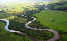
Aksaut River
The length of the rafting is about 75 km; duration - 4-5 days; III category of complexity; seasonality - April-September; means of alloy - kayaks, inflatable boats, rafts, catamarans. The Aksaut River originates from the large Aksautsky glacier, located on the Main Caucasian Range. The rafting usually starts from the village of Aksaut, where you can drive up, from the village of Zelenchukskaya by passing car (by bus you can only get to the village of Khasaut-Grechesky). In the area of the village, the river flows in a wide valley overgrown with mixed forests. Here it is divided by pebble islands into several small but fast foamed arms. After 2 km, all channels merge into one channel 10-15 m wide, and the first threshold of Aksaut begins, 300-400 m long. At the end of its steep 1.5-meter discharge.
Behind suspension bridge after the threshold, the river again spreads widely over the valley for 3-4 km, then follows the narrowing of the channel and in it - the second threshold. 100 m below the threshold - a canyon about 2 km long. A relatively calm 700-meter section separates the canyon from a 1-km-long steeply falling section with a cascade of complex rapids that end behind the bridge over the Aksaut. This entire 8-kilometer stretch below the mouth of the Khalega River, with a slope of about 18 m / km, must be carefully explored. Below the bridge, a calm section of the river begins, which stretches almost to a dairy farm 3-4 km above the village of Krasny Karachay. Behind the farm, Aksaut flows in one channel, its slope increases, a series of complex rapids requiring detailed exploration is formed, alternating with shivers and less often with short sections of rapids.
Approximately 7 km below Krasny Karachay, the road passes to the left bank, and perhaps the most dangerous rapids of the river begin behind the bridge. 200 m below the bridge - the first one, which stretches for about 2 km and is separated from the second "explosive" threshold by a stretch. In the area of the "explosive" threshold, huge blocks impound the river, forming a stormy drain. Behind the threshold, Aksaut, already narrow, is even more compressed by low steep walls of a simple (about 300 m long) canyon, where there are single stones, steps with short plumes. Below the canyon, the rapids are more isolated and shorter, separated by long stretches of rapids where it is easy to land on the shore. The gorge here is deaf and wooded. In front of the village of Khasaut-Grecheskoye, there is a second “explosive” threshold in the way of water workers: the river here is almost completely blocked by stones.
Behind the forestry, Aksaut spreads widely in channels, winding among the banks overgrown with willows, therefore, when the water is low, it is recommended to end the hike in Khasaut-Greek. In high water, the rafting can be continued for another 20 km - to the village of Kardonikskaya, from where by regular bus you can get to Cherkessk.
Aksaut is one of the most high-water rivers flowing through the territory of Karachay-Cherkessia. It originates from the glacier of the same name and merges with the Marukh River 75 kilometers from the source, forming the Maly Zelenchuk River.
Aksaut flows through a valley stretching from south to north between high mountain ranges Mysty-Bashi and Aksaut. This ridge in some areas has different names: Gitche-Teberdinsky, Ak, Baduksky, Khadzhibeysky, Kynyr-Chat, Gidamsky and others. But in general, this complex knot of mountain ranges, dissected by valleys and gorges, can be called Aksautsko-Teberda. In its system there are passes: Alibek, Gitche-Teberda, Seventy-three, Khuty, Baduk, Muhu, etc.
There are a large number of lakes on the Mysty-Bashi ridge, but many of them are little known.
The upper reaches of the valley close the chain of high rocky peaks: Kara-Kaya (3896 m), Aksaut (3910 m), Maly

Dzhalovchat (3600 m), Dzhalovchat (3870 m), etc. The huge massif of Aksaut rises above all the surrounding peaks and ridges.
About 50 tributaries flow into the Aksaut River. The most abundant of them are: Djalovchat, Gitche-Teberda, Khalega, Khadyuka, Bolshaya Marka.
The Aksaut valley is rich in forests that have taken over the slopes of the ridges from their foot to subalpine meadows. Above the mouth of the Khadyuka, the bottom of the valley is also covered with forest. In the upper reaches of the Aksaut, in amazing proximity to the glaciers, a site of an old fir forest has been preserved. This small island of coniferous forest makes an unusual impression with its wildness and primeval untouchedness. It seems that you find yourself not in a forest, but in an underwater kingdom: long strands of lichen barely noticeably move like algae. Even the wind does not penetrate here. Complete silence, only in the canyon Jalovchat makes a dull noise. Local forests give a special charm to Aksaut landscapes, strikingly contrasting with snow spots scattered on the slopes of rocky peaks and glaciers.
There are many predatory animals and wild animals in the forests: bear, deer, wild boar, wolf, forest cat, lynx, marten and others.
The climate of the Aksaut valley is typical for mountain valleys. It depends on the height above sea level, position among the mountain ranges, the degree of dissection of the relief, the proximity of the Main Caucasian Range and the penetration of wet masses from the southwest. sea air. In general, the climate of the upper reaches of the valley is not much different from the climate of Dombai, and in the area of the village of Krasny Karachay it is the same as in Teberda. But in winter, more snow falls here, since this area is located at an altitude of 1560 meters above sea level, that is, 260 meters higher than Teberda,
The natural conditions of the Aksaut valley are so rich and varied that it is of great interest not only for tourists, but also for climbers.
The upper reaches of the valley are a kind of climbing "neighborhood". Here you can climb routes from 1 to V category of difficulty.
A dirt road leads along the Aksaut valley, which starts from the village of Kardonikskaya. Along the way, after 18 kilometers, in a picturesque area, the village of Khasaut-Greek is located. Behind it, after 25 kilometers, at the mouth of the Bolshaya Marka, is the village of Krasny Karachay, which is the starting point for hiking from the Aksaut valley. Tourist routes leading from Arkhyz to Teberda and from Teberda to Arkhyz converge here. A path passes through the village to the upper reaches of the Aksaut and further through the passes to the valleys of Marukh, Alibek, to Dombai, to the lakes of Baduk, Kynyr-Chat and Khaleg, to the waterfalls of Hadyuk, Ullu-Chuchkhur and other places of interest.
The abundance of tourist routes, the richness and beauty of nature create exceptionally favorable conditions for mountain travel in the Aksaut valley and put it among the best tourist areas of the Stavropol Territory.
ROUTES FROM THE AKSOUT VALLEY
Lake Kynyr-Chat
The path to the rarely visited lake Kynyr-Chat starts from the eastern outskirts of the village of Krasny Karachay. Behind the aul, the path immediately deepens into the forest and leads higher and higher, skirting the rocky massif of the Kynyr-Chat mountain from the north.
Having crossed one of its spurs, the path leads to the Gidam tract to the Igda stream, which originates from the lake Kynyr-Chat, which means “crooked hollow”. Further, the path goes upstream of the stream. As you rise, the view of the Aksaut valley opens up wider and wider,
Soon a small nameless lake is encountered, into which the Igda stream flows and then flows out.
Lake Kynyr-Chat, as if gem, hidden in a frame high mountains. Calm, reliably protected from the winds by a semicircle of rocky spurs of Kynyr-Chat, which reared its peak at 3,540 meters above sea level, it appears unexpectedly.
Kynyr-Chat lies at an altitude of more than 2,900 meters above sea level. The surrounding landscape is harsh, but it will captivate the eyes for a long time with its grandeur and beauty. Lake Kynyr-Chat deserves to become popular among tourists, despite some remoteness from the main tourist areas - Teberda and Arkhyz.
One day is enough for an excursion to the lake from the village of Krasny Karachay.
Ullu-Chuchkhur
About 12 kilometers from the village of Krasny Karachay, along the Aksaut valley, the road passes to the right bank and leads through the forest. Soon, behind the bridge, a large clearing opens up. 3a it, after a few kilometers, the second, called Byshlak-Tapkha, which means “cheese shelf”. From here, it's about an hour's walk to the waterfall.
The third glade at the mouth of the Gitche-Teberda lies at an altitude of 1,680 meters above sea level. Previously, there was a small village Rudnichny. Already from here you can hear the sound of the waterfall, but the path from the village of Krasny Karachay to the mouth of Gitche-Teberda is not close. It's time to take care of the lodging for the night, you can admire the waterfall later.

There are many waterfalls in the mountains, but Ullu-Chuchkhur is special, unlike the others. It has its own, unique beauty, its own “symphony” of noise, its own charm. The water is cold as ice, clean, surprisingly transparent, like in the Teberda River. Therefore, the river is called Gitche-Teberda, that is, little Teberda.
From sheer multi-meter rocks, from ledge to ledge, with noise and roar, a river full of water in summer falls, forming a waterfall of rare beauty. At the place of its confluence, the water boils, roars white with foam, and, breaking out of the bubbling cauldron, either rushes furiously onto the shores, or with all the power of the wave it jumps on the pitfalls, raising spray.
Rocks, pine trees and a waterfall bluish-white from the foam blend surprisingly harmoniously into the surrounding landscape.
It is interesting to walk at least a little along the path leading to the Gitche-Teberdy valley, from where a wonderful view of the rocky pyramid - the majestic peak of Kara-Kai opens.
From Aksaut to Dombay
We already know the way to the Rudnichnaya glade at the mouth of Gitche-Teberda along the route “Ullu-Chuchkhur” (88). From the glade a good zigzag path leads to the valley of the river Gitche-Teberda. On the way from one of the turns you can see a waterfall. Behind the forest zone, in the upper reaches of the valley, a low ridge rises with two passes: Gitche-Teberdy and to the left of Seventy-three, through which you can go to the Alibek valley.
After an hour and a half of walking Gitche-Teberda gradually turns to the left. In the upper reaches of the valley, on the left, the rocky peak Bolshaya Marka (3,768 m) opens, dominating the surrounding ridges. A crest humiliated by the “gendarmes” departs from it to the east and connects with the spur of Semyonov-Bashi. Now you need to focus on a rocky peak rounded from above in such a way as to get to its right slope, steeply falling to the Khuty pass. Gitche-Teberda remains on the left, and the path lies first along the terraces, then along the stone rubble.
The Khuty pass is a depression in a rocky ridge in the form of a wide crevice. From it you can admire the beautiful valleys of the Khuty and Gonachkhir rivers for a long time. On the left you can see a small glacier and the impregnable wall of Semyonov-Bashi.
The descent from the pass is quite steep, but the trail is visible. Sticking to the rocks (on the left), you need to go down a long hollow (in the first half of summer there is still snow in it), then along an old moraine overgrown with twisted birch trees. The outcrops of rocks located along the path of descent must be bypassed on the right. The path leading down the valley is overgrown in places. The Khuty Valley is one of the most wild corners Teberdinsky Reserve. Tourists visit it occasionally, so you can see wild animals here; deer, chamois, tour, and even a bear.
A gentle, tireless path through the valley soon gives way to a steep descent. The trail leads to the river Amanauz at the mouth of Khuty. From here to Dombay is no more than an hour's walk.
From Aksaut to Dombay the transition takes 8-10 hours.
From Aksaut to Alibek
Two ways can be suggested: the first one is through Alibek, the second one is through the Seventy-Three Pass. The last, little known pass from the second half of summer becomes more difficult when a small but rather steep glacier is exposed from under the snow. The Alibek pass, on the contrary, becomes easier in the second half of summer. From the village of Krasny Karachay to the glade of Rudnichnaya, at the mouth of the Gitche-Teberda, the path is already familiar from previous routes.
Having crossed the Gitche-Teberda along the masonry or, if it has not been preserved, wade, you need to go along the edge of the forest to a small clearing with traces of fires. Here, look for an overgrown path that leads beyond the forest zone and climbs a steep slope with rich meadow vegetation.
Further, the path continues to the right along the old path to a small clearing on which huge blocks of rocks lie. This is the so-called "Green Hotel". From here you have to go up the river, then along the moraines, past the lake and the waterfall. In the upper part, behind a rather steep ascent, a red-brown “gendarme” appears. To the left of it is the Alibek pass. There is snow on the saddle all summer.
The descent from the pass is quite steep at first. In the first half of summer it is still covered with snow. Having descended a little, it is better to go obliquely to the left, choosing more sloping places. The trail starts below. In the valley, it connects with the path leading to the Alibek glacier, the most frequently visited by tourists.
The further path does not require a description. Everything is clear here. Beyond the clearing climbing camp“Alibek”, the road leads from it.
From the upper reaches of the Aksaut to the Alibek valley, the transition takes 8-10 hours.
Halega Pass
From the village of Krasny Karachay, the path leads up the valley. About 12 kilometers away, near the bridge over the Aksaut, a path branches off from the road and goes along the left bank. At the Khalega River, you need to go to a well-marked path that turns to the right, to the pass of the same name, located on the Mysty-Bashi ridge. Above, it deviates to a small scree and soon leads to a saddle.
Behind the stream, a short ascent ends with a wide alpine valley. At the barn, the path crosses the scree and leads to the first terrace. From here you can see the rocky pyramid of Kara-Kai. Behind the first terrace is the second. Across the stream, the cold, gloomy Khalega Lake soon opens, near which, at a low altitude, the obelisk of Glory stands alone in memory of those who gave their lives in the battles for the defense of the Marukh Pass. There are dilapidated dugouts near the lake, rusty shells, mines, shells are lying around.
 From the lake to the pass 30-40 minutes walk.
Kara-Kaya seems even more formidable from here. Marukh-Bashi looks majestic and gloomy. But of particular interest is the Marukh Pass covered with glory, visible from here in full view. The western slopes of the Mysty-Bashi ridge are clearly visible, where on August 28, 1942, the 810th Infantry Regiment met with the advance detachment of the Edelweiss Alpine Division and completely defeated it by the end of the day. Prisoners were taken, many trophies were captured - equipment and food.
The 810th regiment fought its way to the aid of its far right neighbor, the 815th rifle regiment, which had been fighting heavy battles in the highlands of the Military Sukhum road for many days. Wishing to alleviate the position of the defenders of the Klukhor Pass, the corps command ordered the 810th Regiment to cross the Khalega Pass, descend into the Aksauta Valley and further, in the Gonachkhir area, reach the Military Sukhumi Highway, where to strike at the Klukhor grouping of the enemy.
From that day on, almost without ceasing for one hour, on the slopes of the Mysty-Bashi ridge, a many-day fierce battle thundered ... mountain passes in this area are covered with unfading glory of heroes who fought to the death and did not let the enemy through in Transcaucasia. Their feat is marked by monuments on the Marukh Pass, in the village of Zelenchukskaya, near Karachaevsk and other places.
From the Khalega pass, the trail leads to the Marukhi valley, from where you can go to the Marukh pass or go down the valley and continue on through the Ozerny pass to Arkhyz,
To the Baduk lakes
From the village of Krasny Karachay to the clearing at the mouth of the Malaya Marka, the path coincides with the route “From Arkhyz to Teberda” (70). Then it goes up the Great Marka valley. Above the forest zone, in a small pine grove, which is clearly visible from afar, you can stop for the night. There will be no more firewood behind the grove. First day hiking will only take 5-6 hours.
From the place of spending the night, you should continue the path until the Aryu-Chat tributary flows into the Great Mark, then climb the first moraine terrace and cross the swampy area. It is better to go along the right bank of the river, past a small lake with rusty water and rocky gates, from which a powerful stream bursts out with noise. This area is easy to bypass on the right. On the way to the right, the blue Markinskoye Lake opens up.
The pass jumper is bounded on the right by the rocky ridge of Bolshaya Marka, on the left - by the massif of the Baduk Fingers peak. The way to the pass jumper goes along a gentle scree slope (there is snow here until August). In the middle of the lintel, on a high moraine ridge, there is a stone pyramid of the tour.
The descent is somewhat more difficult. From the first terrace, which breaks off with rocks, one should go down a hollow, reminiscent of an old channel. You can see the lake below. They descend from the second terrace in the same way. Below the hollow becomes deeper. The trail is already visible here. It is clearly visible to the very Baduk lakes.
The descent from the pass jumper to the trail takes about 40 minutes. And from here it is still about two hours of walking to the lakes, where there are convenient places for spending the night.
From Baduk lakes to Teberda 16 kilometers. This route is only available to hikers with experience in mountain travel and appropriate equipment.